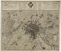
فائل:Carte topographique des environs et du plan de Paris - 1735 - btv1b8442730b.jpg

اصل فائل(۹,۹۳۰ × ۸,۴۶۹ پکسلز, فائل حجم: ۲۲.۶۵ میگابائٹ, MIME type: image/jpeg)

ایہ فائل Wikimedia Commons توں اے تے دوجیاں ویونتاں تے وی ورتی جاسکدی اے۔ گل بات اس دے فائل گل بات صفحہ تے تھلے دتی گئی۔

Warning The original file is very high-resolution. It might not load properly or could cause your browser to freeze when opened at full size.
لکھاری
  • Delagrive, Jean (1689-1757). Auteur du texte
  • Homann (Héritiers de). Auteur du texte
سرخی
Français : Carte topographique des environs et du plan de Paris levée par M. l'Abbé Delagrive et copiée selon l'original parisien par les héritiers de feu Dr Homann.
Deutsch: Karte / von der Gegend und Grundris der Stadt Paris von dem Herrn Abt Delagrive verzeichnet und nach dem parisischen Original ins kleine gebracht und herausgegeben von Homoenischen Erben
تفصیل
Français : Plans de ville; Armoiries; Paris
English: City maps; Coats of arms; Paris
تریخ ۱۷۳۵
date QS:P571,+1735-00-00T00:00:00Z/9
ڈائمنشن Format 590x500
institution QS:P195,Q193563
ہن والی تھاں
département Cartes et plans, GED-3974
ذریعہ/فوٹوگرافر
Gallica
This file comes from Gallica Digital Library and is available under the digital ID ark:/12148/btv1b8442730b

This tag does not indicate the copyright status of the attached work. A normal copyright tag is still required. See Commons:Licensing.

Other languages:
اجازت
(فائل نوں دوبارہ ورتنا)
This is a faithful photographic reproduction of a two-dimensional, public domain work of art. The work of art itself is in the public domain for the following reason:
Public domain

This work is in the public domain in its country of origin and other countries and areas where the copyright term is the author's life plus 100 years or fewer.


This work is in the public domain in the United States because it was published (or registered with the U.S. Copyright Office) before January 1, 1929.

The official position taken by the Wikimedia Foundation is that "faithful reproductions of two-dimensional public domain works of art are public domain".
This photographic reproduction is therefore also considered to be in the public domain in the United States. In other jurisdictions, re-use of this content may be restricted; see Reuse of PD-Art photographs for details.

Captions

Add a one-line explanation of what this file represents

Items portrayed in this file

چترن

media type English

image/jpeg

checksum English

767da4b5515643b2625959ec793b7478d16227c1

determination method English: ؜SHA-1 English

data size English

۲۳,۷۴۷,۸۸۹ بائٹ

height English

۸,۴۶۹ pixel

width English

۹,۹۳۰ pixel

فائل دی تریخ

فائل نو اس ویلے دی حالت وچ ویکھن واسطے تاریخ/ویلے تے کلک کرو۔

تریخ تے ویلہنکی مورتپاسےورتن والاتیپّݨی کرو
موجودہ۱۹:۱۶, ۶ اپریل ۲۰۱۳۱۹:۱۶, ۶ اپریل ۲۰۱۳ ویلے دے ورژن ساتھ انگوٹھاکار روپ۹,۹۳۰ × ۸,۴۶۹ (۲۲.۶۵ میگابائٹ)PierreSelim{{Artwork |Title= {{fr|Carte topographique des environs et du plan de Paris levée par M. l'Abbé Delagrive et copiée selon l'original parisien par les héritiers de feu Dr Homann.}} {{de|Karte / von der Gegend und Grundris der Stadt Paris von dem Her...

تھلے دتے گئے 1 صفحے اس فائل نال جُڑدے نیں

فائل ویاپک ورتوں

ایہہ دوجے وکیاں ایس فائل نوں ورتدے نیں –