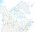
فائل:Canadian National Parks.png

ایس وکھالے دا ناپ: ۷۱۷ × ۶۰۰ پکسلز۔ دوجے ریزولوشنز: ۲۸۷ × ۲۴۰ پکسلز | ۵۷۴ × ۴۸۰ پکسلز | ۹۱۸ × ۷۶۸ پکسلز | ۱,۲۲۴ × ۱,۰۲۴ پکسلز | ۲,۴۴۹ × ۲,۰۴۸ پکسلز | ۲,۷۵۰ × ۲,۳۰۰ پکسلز ۔
اصل فائل (۲,۷۵۰ × ۲,۳۰۰ پکسلز, فائل حجم: ۹۸۹ کلوبائٹ, MIME type: image/png)
فائل دی تریخ
فائل نو اس ویلے دی حالت وچ ویکھن واسطے تاریخ/ویلے تے کلک کرو۔
| تریخ تے ویلہ | نکی مورت | پاسے | ورتن والا | تیپّݨی کرو | |
|---|---|---|---|---|---|
| موجودہ | ۰۳:۱۰, ۶ فروری ۲۰۱۸ |  | ۲,۷۵۰ × ۲,۳۰۰ (۹۸۹ کلوبائٹ) | Nagualdesign | Added Sable Island National Park Reserve. |
| ۰۹:۰۱, ۴ فروری ۲۰۱۸ |  | ۲,۷۵۰ × ۲,۳۰۰ (۹۸۹ کلوبائٹ) | Nagualdesign | Optimize (PNG-24 → PNG-8), crop. | |
| ۰۸:۲۱, ۴ فروری ۲۰۱۸ |  | ۲,۹۰۰ × ۲,۶۰۰ (۳.۱۲ میگابائٹ) | Nagualdesign | Colour National Parks. | |
| ۰۶:۳۵, ۴ فروری ۲۰۱۸ |  | ۲,۹۰۰ × ۲,۶۰۰ (۳.۱۱ میگابائٹ) | Nagualdesign | {{Information |Description={{en|1=Map of Canadian National Parks.}} |Source=https://open.canada.ca/data/en/dataset/9e1507cd-f25c-4c64-995b-6563bf9d65bd |Date=2014-03-27 |Author=Government of Canada |Permission={{OGL-C}} |other_versions= }} |
فائل دی ورتوں
تھلے دتے گئے 1 صفحے اس فائل نال جُڑدے نیں
فائل ویاپک ورتوں
ایہہ دوجے وکیاں ایس فائل نوں ورتدے نیں –
- ban.wikipedia.org تے ورتوں
- de.wikipedia.org تے ورتوں
- en.wikipedia.org تے ورتوں
- List of national parks of Canada
- National parks of Canada
- List of protected areas of Quebec
- List of protected areas of Prince Edward Island
- List of protected areas of Saskatchewan
- List of protected areas of New Brunswick
- List of protected areas of Newfoundland and Labrador
- List of protected areas of Yukon
- List of protected areas of the Northwest Territories
- List of protected areas of Nunavut
- Wildlife of Canada
- User:Nagualdesign/Uploads
- User talk:Nagualdesign/Archive 5
- User:Nagualdesign
- Wikipedia:Graphics Lab/Map workshop/Archive/Nov 2020
- he.wikipedia.org تے ورتوں
- hu.wikipedia.org تے ورتوں
- pa.wikipedia.org تے ورتوں
