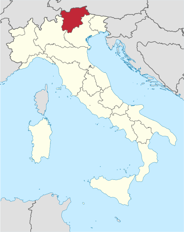
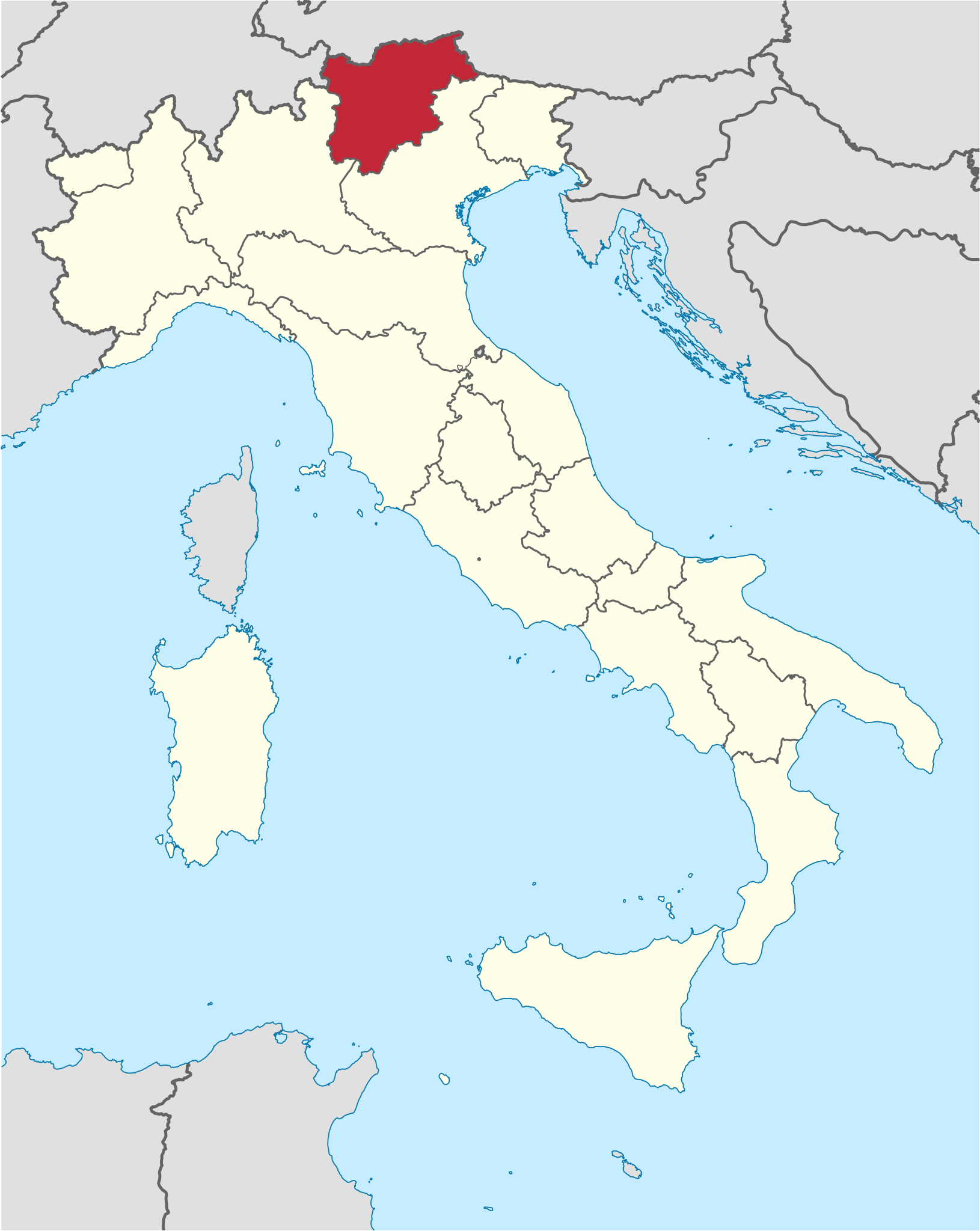
فائل:Trentino-Alto Adige in Italy.svg

Size of this PNG preview of this SVG file: ۴۷۷ × ۵۹۹ پکسلز. دوجے ریزولوشنز: ۱۹۱ × ۲۴۰ پکسلز | ۳۸۲ × ۴۸۰ پکسلز | ۶۱۱ × ۷۶۸ پکسلز | ۸۱۵ × ۱,۰۲۴ پکسلز | ۱,۶۳۰ × ۲,۰۴۸ پکسلز | ۱,۰۳۴ × ۱,۲۹۹ پکسلز ۔
اصل فائل (ایس وی جی فائل، پکسل:۱,۰۳۴ × ۱,۲۹۹، فائل سائز: ۱.۶۷ میگابائٹ)
خلاصہ
.svg)
.svg)
.svg)
.svg)
.svg)
.svg)
.svg)

-en.svg)

.svg)
.svg)
.svg)

_(US48).svg)
_(small_islands_magnified)_(-mini_map_-rivers).svg)
.svg)
_(extra_close)_(US48).svg)
.svg)
_(zoom).svg)

.svg)


_(UNMIK).svg)
.svg)
_(disputed_hatched).svg)
_(claimed_and_disputed_hatched).svg)
.svg)
.svg)
_(%2Ball_claims_hatched).svg)

.svg)
_(shade).svg)
_(shade)_(special_marker).svg)
_(-mini_map).svg)
_(-mini_map).svg)
_(-mini_map).svg)


.svg)

.svg)

لائسنس –
میں، اس کم دے کاپیرائٹ دا مالک، اس کم نوں اس لائسنس دے مطابق چھاپدا واں:

|
کاپی کرن، ونڈن تے بدلن دی ایس ڈوکومنٹ لئی اجازت دتی جاندی اے ایہناں GNU Free Documentation License, Version 1.2 شرطاں نال یا مگروں کسے وی چھپے ورین Free Software Foundation توں بنا کسے انویرینٹ سیکشن دے، ناں فرنٹ کور لکھت تے ناں بیک کور لکھت دے۔ لسنس دی اک کاپی سیکشن وچ ہیگی اے جہدا ناں اے GNU Free Documentation License۔ |
ایس فائل نوں کریٹو کامنز Attribution 2.5 پولینڈ لائسنس دتا گیا.
- تہانوں کھلھ اے:
- حصہ کرنا – کاپی، ونڈنا تے کم بھیجنا
- فیر رلانا – کم نوں فٹ کرنا
- تھلے دتیاں شرطاں نال:
- کس دے ناں – تسیں لازمی ایس کم دے بناں والے بارے دسو جنج اونے آکھیا اے یا جنج لسنس چ آکھیا گیا ہے۔
- اکو جہا شئیر کرو۔ – اگر تسیں بدلدے یا ایس کم تے بناندے تے بنن والے کم نوں اینج دے لسنس نال ای ونڈو گے۔
تسیں اپنی مرضی دا لائسنس چݨ سکدے اوہ۔

|
I'd greatly appreciate, that you attribute this media file to Wikimedia Commons, if used outside Wikipedia or Commons. For use in publications such as books, newspapers, blogs, websites, please insert here the following line:
|
فائل دی تریخ
فائل نو اس ویلے دی حالت وچ ویکھن واسطے تاریخ/ویلے تے کلک کرو۔
| تریخ تے ویلہ | نکی مورت | پاسے | ورتن والا | تیپّݨی کرو | |
|---|---|---|---|---|---|
| موجودہ | ۲۳:۰۷, ۱۷ جون ۲۰۱۱ | | ۱,۰۳۴ × ۱,۲۹۹ (۱.۶۷ میگابائٹ) | Foroa | Reverted to version as of 13:40, 17 June 2011 |
| ۲۲:۴۹, ۱۷ جون ۲۰۱۱ |  | ۱,۰۳۴ × ۱,۲۹۹ (۱.۶۸ میگابائٹ) | Gryffindor | Reverted to version as of 12:50, 17 June 2011 | |
| ۱۸:۴۰, ۱۷ جون ۲۰۱۱ |  | ۱,۰۳۴ × ۱,۲۹۹ (۱.۶۷ میگابائٹ) | TUBS | rv: [http://commons.wikimedia.org/wiki/User_talk:Gryffindor#File:Trentino-Alto_Adige_in_Italy.svg] | |
| ۱۷:۵۰, ۱۷ جون ۲۰۱۱ |  | ۱,۰۳۴ × ۱,۲۹۹ (۱.۶۸ میگابائٹ) | Gryffindor | Reverted to version as of 23:28, 15 June 2011 the depiction of the provinces is in order as they are de-facto regions | |
| ۱۱:۲۱, ۱۶ جون ۲۰۱۱ |  | ۱,۰۳۴ × ۱,۲۹۹ (۱.۶۷ میگابائٹ) | TUBS | Reverted to version as of 06:49, 14 June 2011. Please save as a new file. Borders shouldn't differ in that map series | |
| ۰۴:۲۸, ۱۶ جون ۲۰۱۱ |  | ۱,۰۳۴ × ۱,۲۹۹ (۱.۶۸ میگابائٹ) | Gryffindor | Reverted to version as of 20:15, 13 June 2011 both are autonomous provinces in an autonomous region, others do not have that | |
| ۱۱:۴۹, ۱۴ جون ۲۰۱۱ |  | ۱,۰۳۴ × ۱,۲۹۹ (۱.۶۷ میگابائٹ) | TUBS | Reverted to version as of 12:27, 7 March 2011: please give new filename and move to new category. doesn't make sense: other province borders aren' shown either | |
| ۰۱:۱۵, ۱۴ جون ۲۰۱۱ |  | ۱,۰۳۴ × ۱,۲۹۹ (۱.۶۸ میگابائٹ) | Kmusser | add province boundary | |
| ۱۷:۲۷, ۷ مارچ ۲۰۱۱ |  | ۱,۰۳۴ × ۱,۲۹۹ (۱.۶۷ میگابائٹ) | TUBS |
فائل دی ورتوں
تھلے دتے گئے 1 صفحے اس فائل نال جُڑدے نیں
فائل ویاپک ورتوں
ایہہ دوجے وکیاں ایس فائل نوں ورتدے نیں –
- als.wikipedia.org تے ورتوں
- ar.wikipedia.org تے ورتوں
- ast.wikipedia.org تے ورتوں
- az.wikipedia.org تے ورتوں
- bcl.wikipedia.org تے ورتوں
- bg.wikipedia.org تے ورتوں
- ca.wikipedia.org تے ورتوں
- ceb.wikipedia.org تے ورتوں
- co.wikipedia.org تے ورتوں
- crh.wikipedia.org تے ورتوں
- cs.wikipedia.org تے ورتوں
- cy.wikipedia.org تے ورتوں
- de.wikipedia.org تے ورتوں
- de.wikivoyage.org تے ورتوں
- diq.wikipedia.org تے ورتوں
- el.wikipedia.org تے ورتوں
- en.wikipedia.org تے ورتوں
- eo.wikivoyage.org تے ورتوں
- fi.wikipedia.org تے ورتوں
- frr.wikipedia.org تے ورتوں
- fr.wikipedia.org تے ورتوں
- fr.wiktionary.org تے ورتوں
- ga.wikipedia.org تے ورتوں
- gd.wikipedia.org تے ورتوں
- gl.wikipedia.org تے ورتوں
- ia.wikipedia.org تے ورتوں
- id.wikipedia.org تے ورتوں
- incubator.wikimedia.org تے ورتوں
- it.wikipedia.org تے ورتوں
- it.wikivoyage.org تے ورتوں
- jam.wikipedia.org تے ورتوں
- kab.wikipedia.org تے ورتوں
- ko.wikipedia.org تے ورتوں
- la.wikipedia.org تے ورتوں
- lb.wikipedia.org تے ورتوں
- lij.wikipedia.org تے ورتوں
- lld.wikipedia.org تے ورتوں
- lmo.wikipedia.org تے ورتوں
- lv.wikipedia.org تے ورتوں
ایس فائل دا ویکھو ہور جگت ورتن .