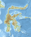
فائل:Sulawesi topography plain.png

ایس وکھالے دا ناپ: ۴۷۵ × ۵۹۹ پکسلز۔ دوجے ریزولوشنز: ۱۹۰ × ۲۴۰ پکسلز | ۳۸۰ × ۴۸۰ پکسلز | ۶۰۹ × ۷۶۸ پکسلز | ۸۱۲ × ۱,۰۲۴ پکسلز | ۲,۲۱۹ × ۲,۷۹۹ پکسلز ۔
اصل فائل (۲,۲۱۹ × ۲,۷۹۹ پکسلز, فائل حجم: ۲.۸۵ میگابائٹ, MIME type: image/png)
فائل دی تریخ
فائل نو اس ویلے دی حالت وچ ویکھن واسطے تاریخ/ویلے تے کلک کرو۔
| تریخ تے ویلہ | نکی مورت | پاسے | ورتن والا | تیپّݨی کرو | |
|---|---|---|---|---|---|
| موجودہ | ۰۸:۳۵, ۲۵ اکتوبر ۲۰۲۰ |  | ۲,۲۱۹ × ۲,۷۹۹ (۲.۸۵ میگابائٹ) | RXerself | hillshade |
| ۱۱:۴۶, ۲۴ اکتوبر ۲۰۲۰ |  | ۲,۲۱۹ × ۲,۷۹۷ (۳.۱۷ میگابائٹ) | RXerself | coastlines | |
| ۱۱:۴۳, ۲۴ اکتوبر ۲۰۲۰ |  | ۲,۲۱۹ × ۲,۷۹۷ (۳.۱۹ میگابائٹ) | RXerself | wider, border, Malaysia, projection, hillshade | |
| ۱۲:۰۸, ۵ فروری ۲۰۱۹ |  | ۲,۲۰۰ × ۲,۵۰۰ (۴.۶۶ میگابائٹ) | RXerself | Towuti outlets, rivers | |
| ۰۱:۲۹, ۳ نومبر ۲۰۱۸ |  | ۲,۱۰۰ × ۲,۵۰۰ (۴.۳۶ میگابائٹ) | RXerself | == {{int:filedesc}} == {{Map |Description= * {{id|Peta topografi Pulau {{W|Sulawesi||id}}.}} * {{en|Topographic map of {{W|Sulawesi}}.}} |Source= {{columns|2| {{id|Karya sendiri; * Topografi, batimetri: [https://www.gebco.net/data_and_products/gridded_bathymetry_data/gebco_30_second_grid/ GEBCO 30 arc-second grid] (domain publik) * Garis pantai, danau: © Kontributor [http://www.openstreetmap.org/ OpenStreetMap] (ODbL) * Sungai: http://tanahair.indonesia.go.id/ }} {{en|Own work; * Topography,... |
فائل دی ورتوں
تھلے دتے گئے 1 صفحے اس فائل نال جُڑدے نیں
فائل ویاپک ورتوں
ایہہ دوجے وکیاں ایس فائل نوں ورتدے نیں –
- ar.wikipedia.org تے ورتوں
- arz.wikipedia.org تے ورتوں
- ast.wikipedia.org تے ورتوں
- az.wikipedia.org تے ورتوں
- ban.wikipedia.org تے ورتوں
- ca.wikipedia.org تے ورتوں
- cy.wikipedia.org تے ورتوں
- en.wikipedia.org تے ورتوں
- Makassar Strait
- Karangetang
- Lore Lindu National Park
- Mount Latimojong
- Mount Rantekombola
- Lake Poso
- Lake Tempe
- Lake Towuti
- Lake Matano
- Mount Colo
- Soputan
- Mount Mahawu
- Mount Lokon
- Mount Empung
- Mount Sempu
- Mount Tondano
- Banua Wuhu
- Submarine 1922
- Mount Tangkoko
- Module:Location map/data/Indonesia Sulawesi/doc
- Selayar Strait
- 2008 Sulawesi earthquake
- 2009 Sulawesi superbolide
- Jeneberang River
- Manado River
- Sadang River
- Poso River
- Palu River
- Karama River
- Walanae River
- Kalaena River
- Sampara River
- Bongka River
- Marisa River
- Paguyaman River
ایس فائل دا ویکھو ہور جگت ورتن .

