فائل:Strait of Dover MODIS.jpg

ایس وکھالے دا ناپ: ۶۰۰ × ۶۰۰ پکسلز۔ دوجے ریزولوشنز: ۲۴۰ × ۲۴۰ پکسلز | ۴۸۰ × ۴۸۰ پکسلز | ۷۶۸ × ۷۶۸ پکسلز | ۱,۰۲۴ × ۱,۰۲۴ پکسلز | ۱,۶۰۰ × ۱,۶۰۰ پکسلز ۔
اصل فائل (۱,۶۰۰ × ۱,۶۰۰ پکسلز, فائل حجم: ۱.۲۱ میگابائٹ, MIME type: image/jpeg)
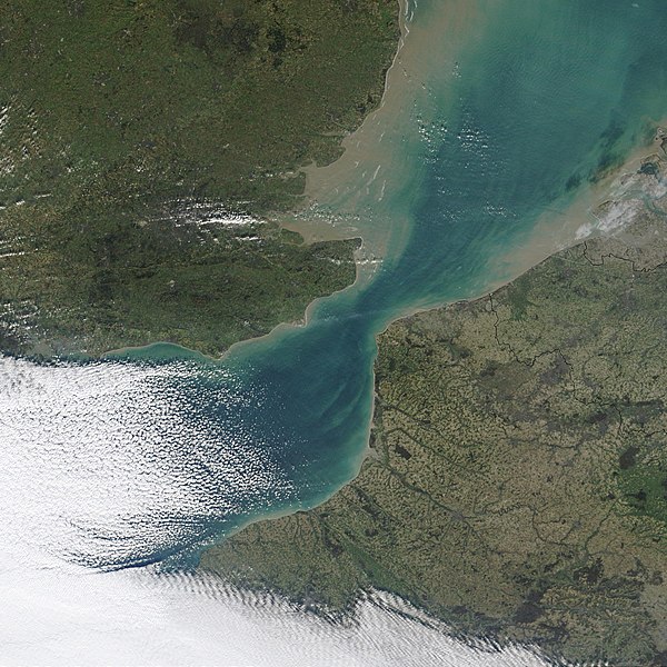
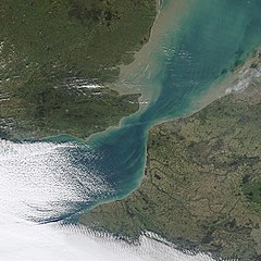
| تفصیل | NASA MODIS satellite imagery of the Strait of Dover, the narrowest part of the English Channel. | |||||
| تریخ | ||||||
| سروت | NASA Visible Earth, original image | |||||
| لکھاری | NASA | |||||
| اجازت (فائل نوں دوبارہ ورتنا) |
|

فائل دی تریخ
فائل نو اس ویلے دی حالت وچ ویکھن واسطے تاریخ/ویلے تے کلک کرو۔
| تریخ تے ویلہ | نکی مورت | پاسے | ورتن والا | تیپّݨی کرو | |
|---|---|---|---|---|---|
| موجودہ | ۰۵:۰۲, ۴ نومبر ۲۰۰۶ | | ۱,۶۰۰ × ۱,۶۰۰ (۱.۲۱ میگابائٹ) | Coredesat | {{Information |Description=NASA MODIS satellite imagery of the Strait of Dover, the narrowest part of the English Channel. |Source=[http://visibleearth.nasa.gov/view_detail.php?id=4664 NASA Visible Earth], [http |
فائل دی ورتوں
تھلے دتے گئے 1 صفحے اس فائل نال جُڑدے نیں
فائل ویاپک ورتوں
ایہہ دوجے وکیاں ایس فائل نوں ورتدے نیں –
- af.wikipedia.org تے ورتوں
- ar.wikipedia.org تے ورتوں
- ca.wikipedia.org تے ورتوں
- da.wikipedia.org تے ورتوں
- de.wikipedia.org تے ورتوں
- el.wikipedia.org تے ورتوں
- en.wikipedia.org تے ورتوں
- en.wiktionary.org تے ورتوں
- eo.wikipedia.org تے ورتوں
- es.wikipedia.org تے ورتوں
- fa.wikipedia.org تے ورتوں
- fi.wikipedia.org تے ورتوں
- fr.wikipedia.org تے ورتوں
- hy.wikipedia.org تے ورتوں
- it.wikipedia.org تے ورتوں
- ja.wikipedia.org تے ورتوں
- ko.wikipedia.org تے ورتوں
- ky.wikipedia.org تے ورتوں
- lt.wikipedia.org تے ورتوں
- no.wikipedia.org تے ورتوں
- pl.wikipedia.org تے ورتوں
- pl.wiktionary.org تے ورتوں
- pt.wikipedia.org تے ورتوں
- sh.wikipedia.org تے ورتوں
- sl.wikipedia.org تے ورتوں
- sr.wikipedia.org تے ورتوں
- sv.wikipedia.org تے ورتوں
- tl.wikipedia.org تے ورتوں
- ur.wikipedia.org تے ورتوں
- zh.wikipedia.org تے ورتوں