فائل:Map-antarctica-ross-ice-shelf-red-x.png
اس توں وڈی مورت موجود نہیں۔
Map-antarctica-ross-ice-shelf-red-x.png (۳۱۶ × ۳۱۳ پکسلز, فائل حجم: ۲۶ کلوبائٹ, MIME type: image/png)
| تفصیل |
|
| تریخ | (UTC) |
| سروت | |
| لکھاری |
|
| دوجے ورژن | Derivative works of this file: Antarctica map indicating Antarctic Peninsula.JPG |
| This is a retouched picture, which means that it has been digitally altered from its original version. Modifications: Cropped, put in red X on the Ross ice shelf.. The original can be viewed here: Antarctica Map.png:
|
This image is in the public domain because it contains materials that originally came from the United States Central Intelligence Agency's World Factbook.
|
 |
پہلا اپلوڈ دا ریکارڈ
This image is a derivative work of the following images:
- File:Antarctica_Map.png licensed with PD-USGov-CIA-WF
- 2004-12-15T23:16:35Z Mschlindwein 502x617 (53433 Bytes)
Uploaded with derivativeFX
فائل دی تریخ
فائل نو اس ویلے دی حالت وچ ویکھن واسطے تاریخ/ویلے تے کلک کرو۔
| تریخ تے ویلہ | نکی مورت | پاسے | ورتن والا | تیپّݨی کرو | |
|---|---|---|---|---|---|
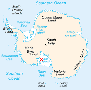
| موجودہ | ۲۲:۲۲, ۱۶ فروری ۲۰۰۹ | | ۳۱۶ × ۳۱۳ (۲۶ کلوبائٹ) | Jeandré du Toit | {{Information |Description=*Map of Antarctica with a red X on the Ross ice shelf. |Source=*File:Antarctica_Map.png |Date=2009-02-16 17:20 (UTC) |Author=*File:Antarctica_Map.png *derivative work: ~~~ |Permission=see below |other_versions= }} { |
فائل دی ورتوں
اس فائل نال جڑیا کوئی صفحہ نئیں۔
فائل ویاپک ورتوں
ایہہ دوجے وکیاں ایس فائل نوں ورتدے نیں –
- en.wikipedia.org تے ورتوں
- fi.wikipedia.org تے ورتوں
- gv.wikipedia.org تے ورتوں
- id.wikipedia.org تے ورتوں
- ja.wikipedia.org تے ورتوں
- mk.wikipedia.org تے ورتوں
- ms.wikipedia.org تے ورتوں
- pt.wikipedia.org تے ورتوں
- zh.wikipedia.org تے ورتوں