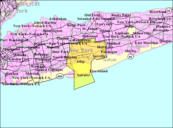
فائل:Islip-town-map.gif
Islip-town-map.gif (۵۷۵ × ۴۲۵ پکسلز, فائل حجم: ۴۸ کلوبائٹ, MIME type: image/gif)
فائل دی تریخ
فائل نو اس ویلے دی حالت وچ ویکھن واسطے تاریخ/ویلے تے کلک کرو۔
| تریخ تے ویلہ | نکی مورت | پاسے | ورتن والا | تیپّݨی کرو | |
|---|---|---|---|---|---|
| موجودہ | ۱۵:۵۶, ۲۲ اگست ۲۰۱۳ |  | ۵۷۵ × ۴۲۵ (۴۸ کلوبائٹ) | File Upload Bot (Magnus Manske) | Transfered from en.wikipedia by User:Milicevic01 using CommonsHelper |
| ۱۵:۵۵, ۲۲ اگست ۲۰۱۳ |  | ۵۷۵ × ۴۲۵ (۴۸ کلوبائٹ) | File Upload Bot (Magnus Manske) | Transfered from en.wikipedia by User:Milicevic01 using CommonsHelper |
فائل دی ورتوں
تھلے دتے گئے 1 صفحے اس فائل نال جُڑدے نیں
فائل ویاپک ورتوں
ایہہ دوجے وکیاں ایس فائل نوں ورتدے نیں –
- ar.wikipedia.org تے ورتوں
- arz.wikipedia.org تے ورتوں
- de.wikipedia.org تے ورتوں
- en.wikipedia.org تے ورتوں
- es.wikipedia.org تے ورتوں
- fr.wikipedia.org تے ورتوں
- ht.wikipedia.org تے ورتوں
- nl.wikipedia.org تے ورتوں
- sh.wikipedia.org تے ورتوں
- sr.wikipedia.org تے ورتوں
- sv.wikipedia.org تے ورتوں
- tt.wikipedia.org تے ورتوں
- ur.wikipedia.org تے ورتوں
- www.wikidata.org تے ورتوں


