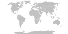
فائل:Island nations.svg

Size of this PNG preview of this SVG file: ۸۰۰ × ۴۱۱ پکسلز. دوجے ریزولوشنز: ۳۲۰ × ۱۶۴ پکسلز | ۶۴۰ × ۳۲۹ پکسلز | ۱,۰۲۴ × ۵۲۶ پکسلز | ۱,۲۸۰ × ۶۵۷ پکسلز | ۲,۵۶۰ × ۱,۳۱۴ پکسلز | ۸۶۳ × ۴۴۳ پکسلز ۔
اصل فائل (ایس وی جی فائل، پکسل:۸۶۳ × ۴۴۳، فائل سائز: ۱.۵۵ میگابائٹ)
فائل دی تریخ
فائل نو اس ویلے دی حالت وچ ویکھن واسطے تاریخ/ویلے تے کلک کرو۔
| تریخ تے ویلہ | نکی مورت | پاسے | ورتن والا | تیپّݨی کرو | |
|---|---|---|---|---|---|
| موجودہ | ۱۶:۱۵, ۲۵ ستمبر ۲۰۲۳ |  | ۸۶۳ × ۴۴۳ (۱.۵۵ میگابائٹ) | Seabourn101 | Reverted to version as of 22:34, 31 May 2023 (UTC) |
| ۲۳:۵۵, ۱۲ ستمبر ۲۰۲۳ |  | ۸۶۳ × ۴۴۳ (۱.۵۵ میگابائٹ) | Taekhosong | Reverted to version as of 09:33, 1 August 2018 (UTC) | |
| ۰۳:۳۴, ۱ جون ۲۰۲۳ |  | ۸۶۳ × ۴۴۳ (۱.۵۵ میگابائٹ) | Przemub | Reverted to version as of 16:20, 5 April 2023 (UTC). Another land border there is the one with Akrotiri and Dhekelia, which is internationally recognised. | |
| ۱۳:۲۷, ۷ اپریل ۲۰۲۳ |  | ۸۶۳ × ۴۴۳ (۱.۵۹ میگابائٹ) | Discombobulates | Cyprus shouldn't have a land border, the TRNC is recognised only by one country, its occupier | |
| ۲۱:۲۰, ۵ اپریل ۲۰۲۳ |  | ۸۶۳ × ۴۴۳ (۱.۵۵ میگابائٹ) | Jeffhardyfan08 | wrong file | |
| ۲۱:۲۰, ۵ اپریل ۲۰۲۳ |  | ۱,۰۰۰ × ۵۱۴ (۲۷ کلوبائٹ) | Jeffhardyfan08 | Added Greenland | |
| ۱۱:۳۸, ۲۵ اپریل ۲۰۲۲ |  | ۸۶۳ × ۴۴۳ (۱.۵۵ میگابائٹ) | Seabourn101 | Reverted to version as of 15:08, 1 September 2018 (UTC)- revert Unexplained reversion | |
| ۰۹:۲۶, ۲۰ اپریل ۲۰۲۲ |  | ۸۶۳ × ۴۴۳ (۱.۵۵ میگابائٹ) | Vodi.Dino.Eri | Reverted to version as of 20:31, 18 December 2015 (UTC) | |
| ۲۰:۰۸, ۱ ستمبر ۲۰۱۸ |  | ۸۶۳ × ۴۴۳ (۱.۵۵ میگابائٹ) | 行到水穷处 | Reverted to version as of 16:05, 15 August 2018 (UTC) (as discussed) | |
| ۱۹:۰۵, ۱ ستمبر ۲۰۱۸ |  | ۸۶۳ × ۴۴۳ (۱.۵۵ میگابائٹ) | 行到水穷处 | Reverted to version as of 09:33, 1 August 2018 (UTC) (No specific comment is provided for the last edit) |
فائل دی ورتوں
تھلے دتے گئے 1 صفحے اس فائل نال جُڑدے نیں
فائل ویاپک ورتوں
ایہہ دوجے وکیاں ایس فائل نوں ورتدے نیں –
- af.wikipedia.org تے ورتوں
- ar.wikipedia.org تے ورتوں
- az.wikipedia.org تے ورتوں
- bn.wikipedia.org تے ورتوں
- bs.wikipedia.org تے ورتوں
- ca.wikipedia.org تے ورتوں
- ckb.wikipedia.org تے ورتوں
- da.wikipedia.org تے ورتوں
- de.wikipedia.org تے ورتوں
- en.wikipedia.org تے ورتوں
- eo.wikipedia.org تے ورتوں
- et.wikipedia.org تے ورتوں
- eu.wikipedia.org تے ورتوں
- fa.wikipedia.org تے ورتوں
- fa.wikibooks.org تے ورتوں
- fi.wikipedia.org تے ورتوں
- fr.wikipedia.org تے ورتوں
- fr.wiktionary.org تے ورتوں
- gag.wikipedia.org تے ورتوں
- gl.wikipedia.org تے ورتوں
- he.wikipedia.org تے ورتوں
- hi.wikipedia.org تے ورتوں
- hu.wikipedia.org تے ورتوں
- ia.wikipedia.org تے ورتوں
- id.wikipedia.org تے ورتوں
- ig.wikipedia.org تے ورتوں
- ilo.wikipedia.org تے ورتوں
- inh.wikipedia.org تے ورتوں
- is.wiktionary.org تے ورتوں
- it.wikipedia.org تے ورتوں
- ja.wikipedia.org تے ورتوں
- ko.wikipedia.org تے ورتوں
- la.wikipedia.org تے ورتوں
ایس فائل دا ویکھو ہور جگت ورتن .

