فائل:Indian Rebellion of 1857.jpg

ایس وکھالے دا ناپ: ۷۱۳ × ۵۹۹ پکسلز۔ دوجے ریزولوشنز: ۲۸۶ × ۲۴۰ پکسلز | ۵۷۱ × ۴۸۰ پکسلز | ۹۱۴ × ۷۶۸ پکسلز | ۱,۲۱۸ × ۱,۰۲۴ پکسلز | ۱,۹۵۹ × ۱,۶۴۷ پکسلز ۔
اصل فائل (۱,۹۵۹ × ۱,۶۴۷ پکسلز, فائل حجم: ۲.۸۲ میگابائٹ, MIME type: image/jpeg)
خلاصہ
| Description |
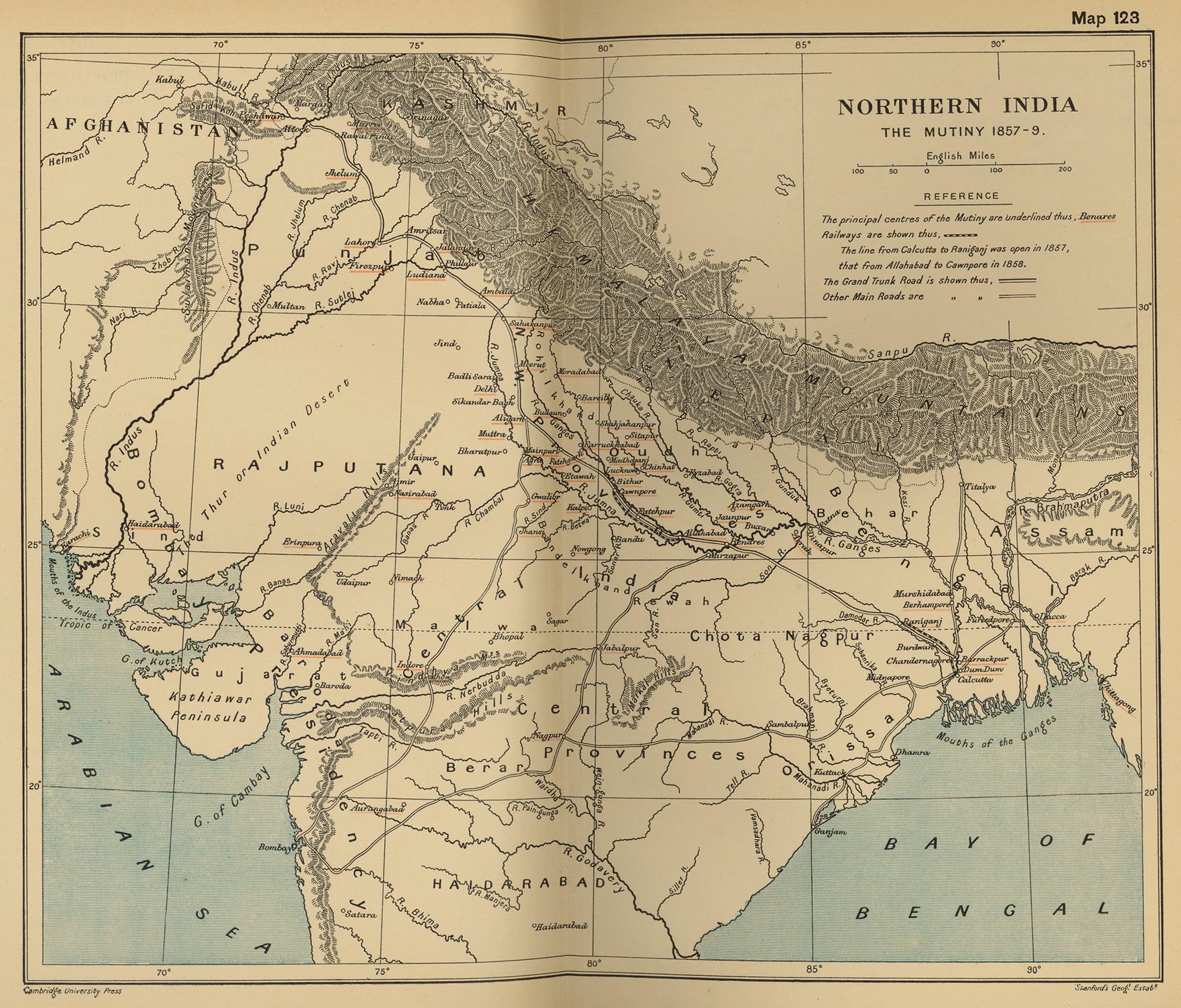
English: Map, "North India: The Mutiny 1857-9" from "The Cambridge Modern History Atlas". Cambridge University Press; London. 1912.
Editors were Sir Adolphus William Ward (†1924), G.W. Prothero (†1922), and Sir Stanley Mordaunt Leathes (†1938). Individual authors of works making up the atlas are not identified, nor are the likely to be, after reasonable research. Español: Mapa del norte de India |
|||||||||
| تریخ | ||||||||||
| سروت | Perry-Castañeda Library Map Collection Website. | |||||||||
| Creator |
Unknown author Cambridge University Press; Stanford's Geogl. Estabt.. |
|||||||||
| Geotemporal data | ||||||||||
| Bounding box |
|
|||||||||
| Georeferencing | ||||||||||
| دوجے ورژن |
|
|||||||||

لائسنس –
|
This is a faithful photographic reproduction of a two-dimensional, public domain work of art. The work of art itself is in the public domain for the following reason:
The official position taken by the Wikimedia Foundation is that "faithful reproductions of two-dimensional public domain works of art are public domain".
This photographic reproduction is therefore also considered to be in the public domain in the United States. In other jurisdictions, re-use of this content may be restricted; see Reuse of PD-Art photographs for details. | ||||
پہلا اپلوڈ دا ریکارڈ
The original description page was on en.wikipedia (file log). All following user names refer to en.wikipedia.
- 2010-06-06 08:35 PawełMM 1959×1647× (1118753 bytes) vertical strip shadorws removed
- 2010-06-05 12:13 PawełMM 1959×1647× (1201791 bytes) central verticaly part flattened, cropped
- 2008-03-05 02:51 Fowler&fowler 1992×1700× (683065 bytes) Map, "North India: The Mutiny 1857-9" from "The Cambridge Modern History Atlas" edited by Sir Adolphus William Ward, G.W. Prothero, Sir Stanley Mordaunt Leathes, and E.A. Benians. Cambridge University Press; London. 1912. Downloaded by ~~~~ from the [h
- 2008-03-05 02:37 Fowler&fowler 1992×1700× (715404 bytes) Map, "North India: The Mutiny 1857-9" from "The Cambridge Modern History Atlas" edited by Sir Adolphus William Ward, G.W. Prothero, Sir Stanley Mordaunt Leathes, and E.A. Benians. Cambridge University Press; London. 1912. Downloaded by ~~~~ from the [h
فائل دی تریخ
فائل نو اس ویلے دی حالت وچ ویکھن واسطے تاریخ/ویلے تے کلک کرو۔
| تریخ تے ویلہ | نکی مورت | پاسے | ورتن والا | تیپّݨی کرو | |
|---|---|---|---|---|---|
| موجودہ | ۲۰:۳۵, ۱۱ ستمبر ۲۰۱۲ | | ۱,۹۵۹ × ۱,۶۴۷ (۲.۸۲ میگابائٹ) | Yann | color balance, contrast, color corrections |
| ۱۲:۴۵, ۱۸ اکتوبر ۲۰۱۰ |  | ۱,۹۵۹ × ۱,۶۴۷ (۱.۰۷ میگابائٹ) | File Upload Bot (Magnus Manske) | {{BotMoveToCommons|en.wikipedia|year={{subst:CURRENTYEAR}}|month={{subst:CURRENTMONTHNAME}}|day={{subst:CURRENTDAY}}}} {{Information |Description={{en|Map, "North India: The Mutiny 1857-9" from "The Cambridge Modern History Atlas" edited by Sir Adolphus |
فائل دی ورتوں
تھلے دتے گئے 4 صفحے اس فائل نال جُڑدے نیں
فائل ویاپک ورتوں
ایہہ دوجے وکیاں ایس فائل نوں ورتدے نیں –
- ar.wikipedia.org تے ورتوں
- ast.wikipedia.org تے ورتوں
- azb.wikipedia.org تے ورتوں
- bg.wikipedia.org تے ورتوں
- bh.wikipedia.org تے ورتوں
- bn.wikipedia.org تے ورتوں
- br.wikipedia.org تے ورتوں
- cs.wikipedia.org تے ورتوں
- cy.wikipedia.org تے ورتوں
- en.wikipedia.org تے ورتوں
- es.wikipedia.org تے ورتوں
- fr.wikipedia.org تے ورتوں
- hi.wikipedia.org تے ورتوں
- id.wikipedia.org تے ورتوں
- io.wikipedia.org تے ورتوں
- ja.wikipedia.org تے ورتوں
- ka.wikipedia.org تے ورتوں
- lv.wikipedia.org تے ورتوں
- mai.wikipedia.org تے ورتوں
- mr.wikipedia.org تے ورتوں
- ms.wikipedia.org تے ورتوں
- ne.wikipedia.org تے ورتوں
- or.wikipedia.org تے ورتوں
- pa.wikipedia.org تے ورتوں
- pl.wikipedia.org تے ورتوں
- ru.wikipedia.org تے ورتوں
- sd.wikipedia.org تے ورتوں
- simple.wikipedia.org تے ورتوں
- sr.wikipedia.org تے ورتوں
- sv.wikipedia.org تے ورتوں
- ta.wikipedia.org تے ورتوں
- te.wikipedia.org تے ورتوں
- th.wikipedia.org تے ورتوں
- tr.wikipedia.org تے ورتوں
- ur.wikipedia.org تے ورتوں
- vi.wikipedia.org تے ورتوں
- www.wikidata.org تے ورتوں