فائل:Honduras rel 1985.jpg

ایس وکھالے دا ناپ: ۷۴۳ × ۶۰۰ پکسلز۔ دوجے ریزولوشنز: ۲۹۷ × ۲۴۰ پکسلز | ۵۹۵ × ۴۸۰ پکسلز | ۹۵۲ × ۷۶۸ پکسلز | ۱,۱۸۸ × ۹۵۹ پکسلز ۔
اصل فائل (۱,۱۸۸ × ۹۵۹ پکسلز, فائل حجم: ۲۴۰ کلوبائٹ, MIME type: image/jpeg)
خلاصہ
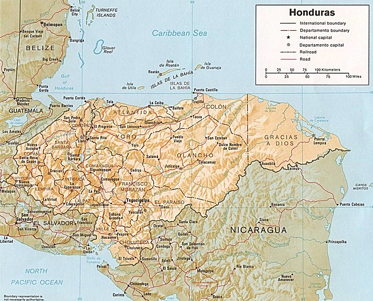
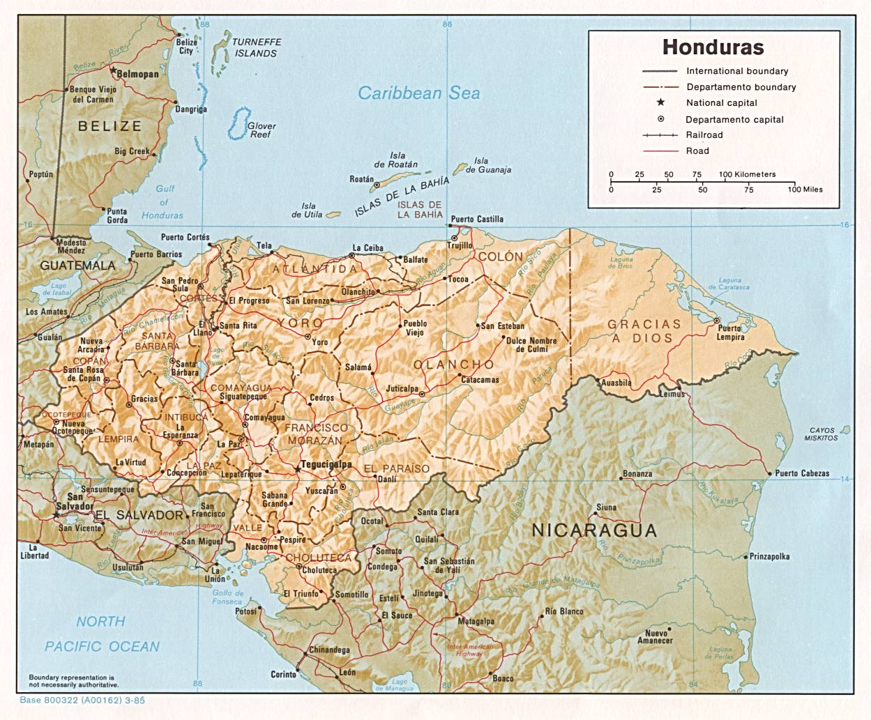
| تفصیل | Shaded relief map of Honduras, in year 1985, showing more than 45 Honduras towns, plus 40 bordering towns, in original JPEG format, 1249 x 1033 pixel, 246kb (labeled for large resizing > 600px width). |
| تریخ | Uploaded 28-October-2005 |
| سروت | Image source URL: http://www.lib.utexas.edu/maps/americas/honduras.jpg; there was no copyright restriction on the containing webpage of the UT Library: UT Perry-Castañeda Library Map Collection - Honduras Maps. |
| لکھاری | US CIA (archived by UT Library) |
| دوجے ورژن | (none yet) |
لائسنس –
| This image is a work of a Central Intelligence Agency employee, taken or made as part of that person's official duties. As a Work of the United States Government, this image or media is in the public domain in the United States.
|

|
-
فائل دی تریخ
فائل نو اس ویلے دی حالت وچ ویکھن واسطے تاریخ/ویلے تے کلک کرو۔
| تریخ تے ویلہ | نکی مورت | پاسے | ورتن والا | تیپّݨی کرو | |
|---|---|---|---|---|---|
| موجودہ | ۱۲:۰۸, ۳ اکتوبر ۲۰۱۷ | | ۱,۱۸۸ × ۹۵۹ (۲۴۰ کلوبائٹ) | ديفيد عادل وهبة خليل 2 | Removed border by cropping 5 % horizontally and 7 % vertically using CropTool with precise mode. |
| ۰۵:۵۲, ۲۸ اکتوبر ۲۰۰۵ |  | ۱,۲۴۹ × ۱,۰۳۳ (۲۴۶ کلوبائٹ) | Brian0918 | Shaded relief map of Honduras, 1985. http://www.lib.utexas.edu/maps/honduras.html {{PD-USGov-CIA}} Category:Maps of Honduras |
فائل دی ورتوں
تھلے دتے گئے 1 صفحے اس فائل نال جُڑدے نیں
فائل ویاپک ورتوں
ایہہ دوجے وکیاں ایس فائل نوں ورتدے نیں –
- arz.wikipedia.org تے ورتوں
- ast.wikipedia.org تے ورتوں
- ba.wikipedia.org تے ورتوں
- ca.wikipedia.org تے ورتوں
- el.wikipedia.org تے ورتوں
- en.wikipedia.org تے ورتوں
- es.wikipedia.org تے ورتوں
- fa.wikipedia.org تے ورتوں
- fr.wikipedia.org تے ورتوں
- gd.wikipedia.org تے ورتوں
- gu.wikipedia.org تے ورتوں
- hu.wikipedia.org تے ورتوں
- hy.wikipedia.org تے ورتوں
- id.wikipedia.org تے ورتوں
- ilo.wikipedia.org تے ورتوں
- io.wikipedia.org تے ورتوں
- is.wikipedia.org تے ورتوں
- it.wikipedia.org تے ورتوں
- ja.wikipedia.org تے ورتوں
- kk.wikipedia.org تے ورتوں
- la.wikipedia.org تے ورتوں
- lv.wikipedia.org تے ورتوں
- mk.wikipedia.org تے ورتوں
- mt.wikipedia.org تے ورتوں
- os.wikipedia.org تے ورتوں
- pa.wikipedia.org تے ورتوں
- pt.wikipedia.org تے ورتوں
- ru.wikipedia.org تے ورتوں
- sh.wikipedia.org تے ورتوں
- sl.wikipedia.org تے ورتوں
- sq.wikipedia.org تے ورتوں
- sr.wikipedia.org تے ورتوں
- ta.wikipedia.org تے ورتوں
- te.wikipedia.org تے ورتوں
- th.wikipedia.org تے ورتوں
- tr.wikipedia.org تے ورتوں
- uk.wikipedia.org تے ورتوں
- www.wikidata.org تے ورتوں
ایس فائل دا ویکھو ہور جگت ورتن .