فائل:Gulf of Finland NLT Landsat7.png

ایس وکھالے دا ناپ: ۸۰۰ × ۳۷۱ پکسلز۔ دوجے ریزولوشنز: ۳۲۰ × ۱۴۸ پکسلز | ۶۴۰ × ۲۹۷ پکسلز | ۱,۰۲۴ × ۴۷۵ پکسلز | ۱,۲۸۰ × ۵۹۳ پکسلز | ۲,۵۰۰ × ۱,۱۵۹ پکسلز ۔
اصل فائل (۲,۵۰۰ × ۱,۱۵۹ پکسلز, فائل حجم: ۴.۷۹ میگابائٹ, MIME type: image/png)
خلاصہ
| تفصیل |
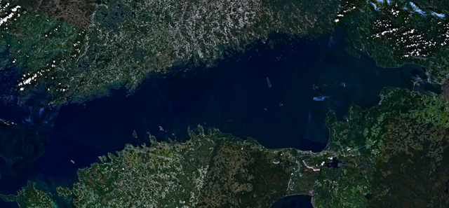
English: Visible colour satellite image of Gulf of Finland.
Русский: Финский залив.
Suomi: Suomenlahti.
Eesti: Soome laht.
Svenska: Finska viken.
Deutsch: Finnische Meerbusen. |
| تریخ | ۱۶ اپریل ۲۰۰۶ (upload date) |
| سروت | Satellite imagery taken from NASA World Wind software (by screenshot), NLT Landsat7 layer. |
| لکھاری | NASA |
لائسنس –
| This image is in the public domain because it is a screenshot from NASA’s globe software World Wind using a public domain layer, such as Blue Marble, MODIS, Landsat, SRTM, USGS or GLOBE.
|
 |
فائل دی تریخ
فائل نو اس ویلے دی حالت وچ ویکھن واسطے تاریخ/ویلے تے کلک کرو۔
| تریخ تے ویلہ | نکی مورت | پاسے | ورتن والا | تیپّݨی کرو | |
|---|---|---|---|---|---|
| موجودہ | ۲۱:۴۱, ۱۸ اپریل ۲۰۰۶ | | ۲,۵۰۰ × ۱,۱۵۹ (۴.۷۹ میگابائٹ) | Hautala | {{PD-WorldWind}} Visible colour satellite image of Gulf of Finland. Screenshot of NASA World Wind, NLT Landsat7 layer. Category:Satellite photos |
فائل دی ورتوں
تھلے دتے گئے 1 صفحے اس فائل نال جُڑدے نیں
فائل ویاپک ورتوں
ایہہ دوجے وکیاں ایس فائل نوں ورتدے نیں –
- ar.wikipedia.org تے ورتوں
- arz.wikipedia.org تے ورتوں
- ast.wikipedia.org تے ورتوں
- ba.wikipedia.org تے ورتوں
- be-tarask.wikipedia.org تے ورتوں
- br.wikipedia.org تے ورتوں
- ca.wikipedia.org تے ورتوں
- cy.wikipedia.org تے ورتوں
- da.wikipedia.org تے ورتوں
- eo.wikipedia.org تے ورتوں
- fy.wikipedia.org تے ورتوں
- ga.wikipedia.org تے ورتوں
- he.wikipedia.org تے ورتوں
- hy.wikipedia.org تے ورتوں
- ms.wikipedia.org تے ورتوں
- mzn.wikipedia.org تے ورتوں
- no.wikipedia.org تے ورتوں
- pt.wikipedia.org تے ورتوں
- ro.wikipedia.org تے ورتوں
- ru.wikinews.org تے ورتوں
- www.wikidata.org تے ورتوں