فائل:Gales Bay.jpg
ایس وکھالے دا ناپ: ۸۰۰ × ۵۳۶ پکسلز۔ دوجے ریزولوشنز: ۳۲۰ × ۲۱۴ پکسلز | ۶۴۰ × ۴۲۹ پکسلز | ۱,۰۲۴ × ۶۸۶ پکسلز | ۱,۲۸۰ × ۸۵۷ پکسلز ۔
اصل فائل (۱,۲۸۰ × ۸۵۷ پکسلز, فائل حجم: ۱۴۶ کلوبائٹ, MIME type: image/jpeg)
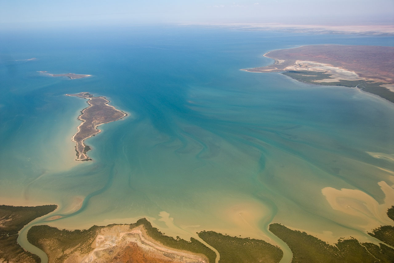
| تفصیل | This is an aerial photograph of Gales Bay, a bay at the south end of Exmouth Gulf, Western Australia. The nearest foreground is Doole Island; behind it is Roberts Island; the further island is possibly Whitmore Island. The land on the right is the Sandalwood Peninsula. In the top right hand corner some of Giralia Bay can just be seen; across the top can be seen the continuing coastline of Western Australia. |
| تریخ | |
| سروت | https://www.flickr.com/photos/61952179@N00/366312114/ |
| لکھاری | Jon Hanson |
| اجازت (فائل نوں دوبارہ ورتنا) |
ایس فائل نوں کریٹو کامنز Attribution 2.0 جنرک لائسنس دتا گیا.
|
| Camera location | | View this and other nearby images on: OpenStreetMap |
|---|
| This image, originally posted to Flickr, was reviewed on 18 May 2008 by the administrator or reviewer Kanonkas, who confirmed that it was available on Flickr under the stated license on that date. |
فائل دی تریخ
فائل نو اس ویلے دی حالت وچ ویکھن واسطے تاریخ/ویلے تے کلک کرو۔
| تریخ تے ویلہ | نکی مورت | پاسے | ورتن والا | تیپّݨی کرو | |
|---|---|---|---|---|---|
| موجودہ | ۱۷:۲۰, ۱۸ مئی ۲۰۰۸ | | ۱,۲۸۰ × ۸۵۷ (۱۴۶ کلوبائٹ) | Hesperian | {{Information |Description=This is an aerial photograph of Gales Bay, a bay at the south end of Exmouth Gulf, Western Australia. The island in the foreground is Doole Island; behind it is Roberts Island; the further island is ''possibl |
فائل دی ورتوں
تھلے دتے گئے 1 صفحے اس فائل نال جُڑدے نیں
فائل ویاپک ورتوں
ایہہ دوجے وکیاں ایس فائل نوں ورتدے نیں –
- ar.wikipedia.org تے ورتوں
- arz.wikipedia.org تے ورتوں
- ceb.wikipedia.org تے ورتوں
- de.wikipedia.org تے ورتوں
- en.wikipedia.org تے ورتوں
- fi.wiktionary.org تے ورتوں
- lt.wikipedia.org تے ورتوں
- nl.wikipedia.org تے ورتوں
- ur.wikipedia.org تے ورتوں
- www.wikidata.org تے ورتوں