فائل:GPS Satellite NASA art-iif.jpg

ایس وکھالے دا ناپ: ۷۴۸ × ۵۹۹ پکسلز۔ دوجے ریزولوشنز: ۳۰۰ × ۲۴۰ پکسلز | ۵۹۹ × ۴۸۰ پکسلز | ۱,۰۰۶ × ۸۰۶ پکسلز ۔
اصل فائل (۱,۰۰۶ × ۸۰۶ پکسلز, فائل حجم: ۱۱۱ کلوبائٹ, MIME type: image/jpeg)
خلاصہ
| تفصیل |
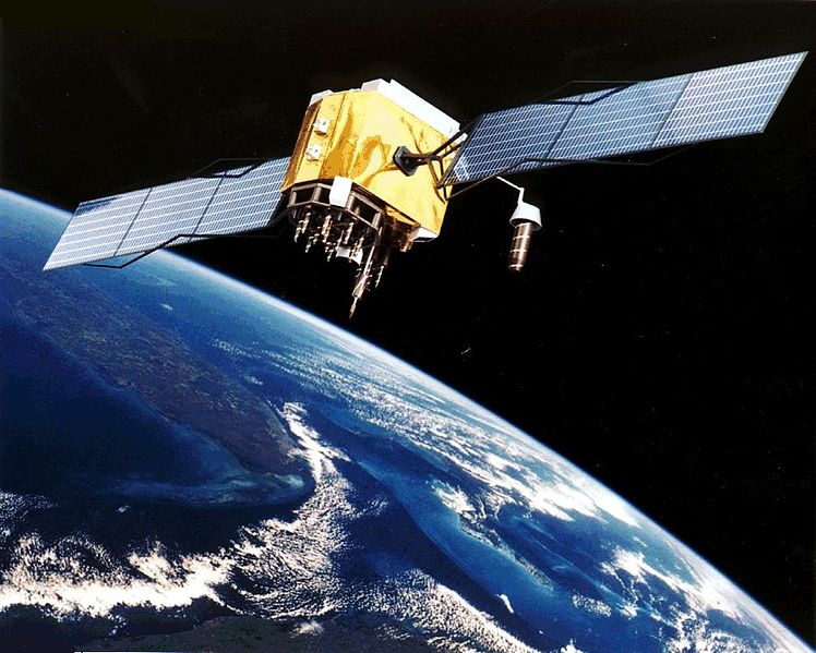
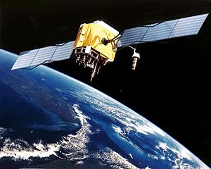
English: Artist's conception of GPS Block II-F satellite in Earth orbit.
Français : Vue d'artiste d'un satellite GPS Block II-F sur orbite terrestre. |
| تریخ | انجان تاریخ |
| سروت | https://www.egraphicbd.com [dead link] (Wayback Machine) |
| لکھاری | NASA |
| دوجے ورژن |

لائسنس –
| This file is in the public domain in the United States because it was solely created by NASA. NASA copyright policy states that "NASA material is not protected by copyright unless noted". (See Template:PD-USGov, NASA copyright policy page or JPL Image Use Policy.) | ||
 |
Warnings:
|
فائل دی تریخ
فائل نو اس ویلے دی حالت وچ ویکھن واسطے تاریخ/ویلے تے کلک کرو۔
| تریخ تے ویلہ | نکی مورت | پاسے | ورتن والا | تیپّݨی کرو | |
|---|---|---|---|---|---|
| موجودہ | ۰۱:۲۰, ۱۰ فروری ۲۰۰۶ | | ۱,۰۰۶ × ۸۰۶ (۱۱۱ کلوبائٹ) | Michaelfavor~commonswiki | Artist Interpretation of GPS satellite, image courtesy of NASA http://www.navcen.uscg.gov/ftp/gps/ggeninfo/gps-iif.tif |
فائل دی ورتوں
تھلے دتے گئے 1 صفحے اس فائل نال جُڑدے نیں
فائل ویاپک ورتوں
ایہہ دوجے وکیاں ایس فائل نوں ورتدے نیں –
- af.wikipedia.org تے ورتوں
- ar.wikipedia.org تے ورتوں
- ba.wikipedia.org تے ورتوں
- be.wikipedia.org تے ورتوں
- bn.wikipedia.org تے ورتوں
- cs.wikipedia.org تے ورتوں
- cv.wikipedia.org تے ورتوں
- da.wikipedia.org تے ورتوں
- de.wikinews.org تے ورتوں
- el.wikipedia.org تے ورتوں
- en.wikipedia.org تے ورتوں
- Navigation
- Dynamic positioning
- Geoinformatics
- Militarisation of space
- GPS signals
- Wikipedia:WikiProject Systems/List of images of systems
- Talk:USA-193
- Help talk:Table/Archive 3
- List of equipment of the United States Armed Forces
- Error analysis for the Global Positioning System
- User:Doggitydogs/GPS
- User:HelpingWorld/sandbox2
- User:Wikiworkr/sandbox
- User:MYBOIIII/sandbox
- Portal:Geodesy
- en.wikibooks.org تے ورتوں
- en.wikiversity.org تے ورتوں
- es.wikipedia.org تے ورتوں
- es.wikinews.org تے ورتوں
- et.wikipedia.org تے ورتوں
- fa.wikipedia.org تے ورتوں
- fi.wikipedia.org تے ورتوں
- fr.wikipedia.org تے ورتوں
ایس فائل دا ویکھو ہور جگت ورتن .