فائل:GOF Photo.jpg

ایس وکھالے دا ناپ: ۸۰۰ × ۶۰۰ پکسلز۔ دوجے ریزولوشنز: ۳۲۰ × ۲۴۰ پکسلز | ۶۴۰ × ۴۸۰ پکسلز | ۱,۰۲۴ × ۷۶۸ پکسلز | ۱,۲۰۰ × ۹۰۰ پکسلز ۔
اصل فائل (۱,۲۰۰ × ۹۰۰ پکسلز, فائل حجم: ۱۸۹ کلوبائٹ, MIME type: image/jpeg)
| تفصیل |
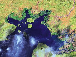
English: Satellite Image of the Gulf of Fonseca
Español: Imagen de satélite del Golfo de Fonseca |
| تریخ | |
| سروت | National Oceanic and Atmospheric Administration |
| لکھاری | NOAA |
| دوجے ورژن |

لائسنس –
This image is in the public domain because it contains materials that originally came from the U.S. National Oceanic and Atmospheric Administration, taken or made as part of an employee's official duties.
|
پہلا اپلوڈ دا ریکارڈ
The original description page was here. All following user names refer to en.wikipedia.
- 2008-01-31 19:23 Mwilburn38 1200×900× (193791 bytes) {{Information |Description=Satellite Image of the Gulf of Fonseca |Source=National Oceanic and Atmospheric Administration |Date=2001 |Location=http://www.noaa.gov |Author=NOAA |Permission= |other_versions= }}
فائل دی تریخ
فائل نو اس ویلے دی حالت وچ ویکھن واسطے تاریخ/ویلے تے کلک کرو۔
| تریخ تے ویلہ | نکی مورت | پاسے | ورتن والا | تیپّݨی کرو | |
|---|---|---|---|---|---|
| موجودہ | ۱۹:۳۸, ۵ اپریل ۲۰۱۰ | | ۱,۲۰۰ × ۹۰۰ (۱۸۹ کلوبائٹ) | Urdangaray | {{Information |Description={{en|Satellite Image of the Gulf of Fonseca}} |Source=Transferred from [http://en.wikipedia.org en.wikipedia]<br/> (Original text : ''National Oceanic and Atmospheric Administration'') |Date=2001<br/> ({{Date|2008|01|31}} (origi |
فائل دی ورتوں
تھلے دتے گئے 1 صفحے اس فائل نال جُڑدے نیں
فائل ویاپک ورتوں
ایہہ دوجے وکیاں ایس فائل نوں ورتدے نیں –
- ar.wikipedia.org تے ورتوں
- ast.wikipedia.org تے ورتوں
- bg.wikipedia.org تے ورتوں
- ca.wikipedia.org تے ورتوں
- ceb.wikipedia.org تے ورتوں
- cs.wikipedia.org تے ورتوں
- de.wikipedia.org تے ورتوں
- en.wikipedia.org تے ورتوں
- eo.wikipedia.org تے ورتوں
- es.wikipedia.org تے ورتوں
- eu.wikipedia.org تے ورتوں
- fa.wikipedia.org تے ورتوں
- fi.wikipedia.org تے ورتوں
- fr.wikipedia.org تے ورتوں
- gl.wikipedia.org تے ورتوں
- hr.wikipedia.org تے ورتوں
- hy.wikipedia.org تے ورتوں
- id.wikipedia.org تے ورتوں
- ilo.wikipedia.org تے ورتوں
- it.wikipedia.org تے ورتوں
- ja.wikipedia.org تے ورتوں
- kk.wikipedia.org تے ورتوں
- ko.wikipedia.org تے ورتوں
- mk.wikipedia.org تے ورتوں
- mr.wikipedia.org تے ورتوں
- mt.wikipedia.org تے ورتوں
- nl.wikipedia.org تے ورتوں
- nn.wikipedia.org تے ورتوں
- no.wikipedia.org تے ورتوں
- pa.wikipedia.org تے ورتوں
- pl.wikipedia.org تے ورتوں
- pt.wikipedia.org تے ورتوں
- ru.wikipedia.org تے ورتوں
ایس فائل دا ویکھو ہور جگت ورتن .