فائل:EtoshaBorders.jpg
ایس وکھالے دا ناپ: ۸۰۰ × ۳۶۵ پکسلز۔ دوجے ریزولوشنز: ۳۲۰ × ۱۴۶ پکسلز | ۶۴۰ × ۲۹۲ پکسلز | ۱,۴۰۶ × ۶۴۲ پکسلز ۔
اصل فائل (۱,۴۰۶ × ۶۴۲ پکسلز, فائل حجم: ۲۷۶ کلوبائٹ, MIME type: image/jpeg)
خلاصہ
| تفصیل |
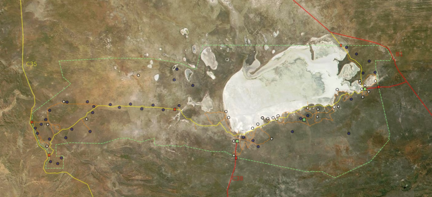
Deutsch: Satellitenbild vom Etosha Park mit Grenzen, Wegen, Wasserstellen, Camps und Toren
English: Satellite picture of Etosha park with borders, roads, waterpoints, camps and gates
Français : Vue satellite de la réserve naturelle d'Etosha, avec les limites, chemins, points d'eau, camps et portes
English: Satellite picture of the park
Français : Vue satellite du parc naturel d'Etosha
Suomi: Etoshan kansallispuisto satelliittikuvassa |
| تریخ | |
| سروت | NASA |
| لکھاری | Modified by Harald Süpfle |
| اجازت (فائل نوں دوبارہ ورتنا) |
NASA public domain |
| دوجے ورژن | cut out of original NASA file (3600x4800): ev11707_Namibia.A2001131.0920.250m.jpg |
لائسنس –
| This file is in the public domain in the United States because it was solely created by NASA. NASA copyright policy states that "NASA material is not protected by copyright unless noted". (See Template:PD-USGov, NASA copyright policy page or JPL Image Use Policy.) | ||
 |
Warnings:
|
فائل دی تریخ
فائل نو اس ویلے دی حالت وچ ویکھن واسطے تاریخ/ویلے تے کلک کرو۔
| تریخ تے ویلہ | نکی مورت | پاسے | ورتن والا | تیپّݨی کرو | |
|---|---|---|---|---|---|
| موجودہ | ۰۳:۳۹, ۱۹ دسمبر ۲۰۰۶ | | ۱,۴۰۶ × ۶۴۲ (۲۷۶ کلوبائٹ) | Hsuepfle | {{Created with Inkscape}} {{Information| |Description = '''de:''' Satellitenbild vom Etosha Park mit Grenzen, Wegen, Wasserstellen, Camps und Toren * rote linie: Teerstraße * gelbe Linie: Piste * Rotes Quadrat: Parktor * Grünes Quadrat: Camp * Blauer K |
| ۰۳:۴۷, ۷ جنوری ۲۰۰۶ |  | ۱,۱۵۰ × ۵۰۴ (۱۷۶ کلوبائٹ) | Hsuepfle | {{Information| |Description = de: Satellitenbild vom Etosha Park mit Grenzen, Wegen, Wasserlöchern, Camps und Toren en: Satellite picture of Etosha park with borders, roads, Water holes, Camps and Gates |Source = NASA |Date = 2006-01-06 |Author = Modif |
فائل دی ورتوں
تھلے دتے گئے 1 صفحے اس فائل نال جُڑدے نیں
فائل ویاپک ورتوں
ایہہ دوجے وکیاں ایس فائل نوں ورتدے نیں –
- af.wikipedia.org تے ورتوں
- be.wikipedia.org تے ورتوں
- bg.wikipedia.org تے ورتوں
- de.wikipedia.org تے ورتوں
- en.wikipedia.org تے ورتوں
- eo.wikipedia.org تے ورتوں
- es.wikipedia.org تے ورتوں
- fi.wikipedia.org تے ورتوں
- hu.wikipedia.org تے ورتوں
- it.wikipedia.org تے ورتوں
- lt.wikipedia.org تے ورتوں
- no.wikipedia.org تے ورتوں
- sk.wikipedia.org تے ورتوں
- sl.wikipedia.org تے ورتوں
- vi.wikipedia.org تے ورتوں
- zh.wikipedia.org تے ورتوں