فائل:Cook chart of New Zealand.jpg
ایس وکھالے دا ناپ: ۴۳۴ × ۵۹۹ پکسلز۔ دوجے ریزولوشنز: ۱۷۴ × ۲۴۰ پکسلز | ۳۴۸ × ۴۸۰ پکسلز | ۵۵۷ × ۷۶۸ پکسلز | ۱,۰۹۳ × ۱,۵۰۸ پکسلز ۔
اصل فائل (۱,۰۹۳ × ۱,۵۰۸ پکسلز, فائل حجم: ۳۰۱ کلوبائٹ, MIME type: image/jpeg)
خلاصہ
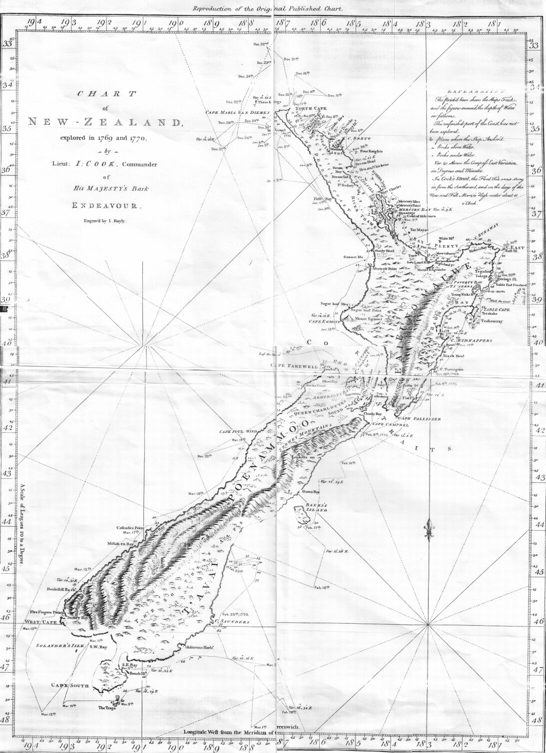
| تفصیل | This is an image of a chart of New Zealand made by Lieutenant (later Captain Sir) James Cook during his 1770 voyage of exploration in the Pacific in command of HM Bark Endeavour. |
| تریخ | |
| سروت | Taken from the Project Gutenberg edition of Captain Cook's Journal, First Voyage, which is based on an 1893 publication of Cook's original manuscript |
| لکھاری | James Cook |
| اجازت (فائل نوں دوبارہ ورتنا) |
It is in the public domain worldwide |
لائسنس –
|
This work is in the public domain in its country of origin and other countries and areas where the copyright term is the author's life plus 100 years or fewer. | |
| ایہ فائل دے بارے چ دس اے جے اے کاپی حف دیاں روکاں توں کھلی اے تے نالدے رلدے حقاں توں وی۔ | |
فائل دی تریخ
فائل نو اس ویلے دی حالت وچ ویکھن واسطے تاریخ/ویلے تے کلک کرو۔
| تریخ تے ویلہ | نکی مورت | پاسے | ورتن والا | تیپّݨی کرو | |
|---|---|---|---|---|---|
| موجودہ | ۰۷:۵۹, ۲۷ ستمبر ۲۰۰۶ | | ۱,۰۹۳ × ۱,۵۰۸ (۳۰۱ کلوبائٹ) | Hesperian | == Summary == {{Information |Description=This is an image of a chart of New Zealand made by Lieutenant (later Captain Sir) James Cook during his 1770 voyage of exploration in the Pacific in command of HM Bark ''Endeavour''. |Source=Taken from the |
فائل دی ورتوں
تھلے دتے گئے 1 صفحے اس فائل نال جُڑدے نیں
فائل ویاپک ورتوں
ایہہ دوجے وکیاں ایس فائل نوں ورتدے نیں –
- cbk-zam.wikipedia.org تے ورتوں
- cs.wikipedia.org تے ورتوں
- cy.wikipedia.org تے ورتوں
- de.wikipedia.org تے ورتوں
- en.wikipedia.org تے ورتوں
- es.wikipedia.org تے ورتوں
- fi.wikipedia.org تے ورتوں
- hu.wikipedia.org تے ورتوں
- ko.wikipedia.org تے ورتوں
- pa.wikipedia.org تے ورتوں
- pl.wikipedia.org تے ورتوں
- sk.wikipedia.org تے ورتوں
- sl.wikipedia.org تے ورتوں
- th.wikipedia.org تے ورتوں
- ur.wikipedia.org تے ورتوں