فائل:Asturias location map.svg

Size of this PNG preview of this SVG file: ۵۱۲ × ۳۷۸ پکسلز. دوجے ریزولوشنز: ۳۲۰ × ۲۳۶ پکسلز | ۶۴۰ × ۴۷۳ پکسلز | ۱,۰۲۴ × ۷۵۶ پکسلز | ۱,۲۸۰ × ۹۴۵ پکسلز | ۲,۵۶۰ × ۱,۸۹۰ پکسلز ۔
اصل فائل (ایس وی جی فائل، پکسل:۵۱۲ × ۳۷۸، فائل سائز: ۱۵۸ کلوبائٹ)
| تفصیل |
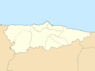
English: Location map of Asturias Equirectangular projection, N/S stretching 130 %. Geographic limits of the map: * N: 44.141° N * S: 42.498° N * W: 7.286° O * E: 4.375° O Español: Mapa de localización de Asturias Proyección equirrectangular, N/S estirada 130 %. Límites geográficos del mapa: * N: 44.141° N * S: 42.498° N * W: 7.286° O * E: 4.375° O |
| تریخ | (UTC) |
| سروت | |
| لکھاری |
|
| دوجے ورژن | Derivative works of this file: Circunscripciones electorales Asturias.svg |
| This is a retouched picture, which means that it has been digitally altered from its original version. Modifications: harmonisation des couleurs. The original can be viewed here: Asturias-loc.svg:
|
میں، اس کم دے کاپیرائٹ دا مالک، اس کم نوں اس لائسنس دے مطابق چھاپدا واں:
ایس فائل نوں کریٹو کامنز Attribution 2.5 پولینڈ لائسنس دتا گیا.
- تہانوں کھلھ اے:
- حصہ کرنا – کاپی، ونڈنا تے کم بھیجنا
- فیر رلانا – کم نوں فٹ کرنا
- تھلے دتیاں شرطاں نال:
- کس دے ناں – تسیں لازمی ایس کم دے بناں والے بارے دسو جنج اونے آکھیا اے یا جنج لسنس چ آکھیا گیا ہے۔
- اکو جہا شئیر کرو۔ – اگر تسیں بدلدے یا ایس کم تے بناندے تے بنن والے کم نوں اینج دے لسنس نال ای ونڈو گے۔
پہلا اپلوڈ دا ریکارڈ
This image is a derivative work of the following images:
- File:Asturias-loc.svg licensed with Cc-by-sa-3.0
- 2010-05-07T11:44:07Z Miguillen 512x378 (272467 Bytes) {{Information |Description=Mapa delocalización del Principado de Asturias |Source={{own}} |Date=2009-05-07 |Author=[[User:Miguillen|Miguillen]] |Permission= |other_versions= }} [[Category:Maps of Asturias]]
Uploaded with derivativeFX
فائل دی تریخ
فائل نو اس ویلے دی حالت وچ ویکھن واسطے تاریخ/ویلے تے کلک کرو۔
| تریخ تے ویلہ | نکی مورت | پاسے | ورتن والا | تیپّݨی کرو | |
|---|---|---|---|---|---|
| موجودہ | ۱۶:۰۷, ۱۹ مئی ۲۰۱۰ | | ۵۱۲ × ۳۷۸ (۱۵۸ کلوبائٹ) | Miguillen | borde de costa |
| ۱۴:۴۹, ۱۸ مئی ۲۰۱۰ |  | ۵۱۲ × ۳۷۸ (۱۴۴ کلوبائٹ) | Xfigpower | {{Information |Description={{en|Location map of Asturias}} Equirectangular projection, N/S stretching 130 %. Geographic limits of the map: * N: 44.141° N * S: 42.498° N * W: 7.286° O * E: 4.375° O {{es|Mapa de localización de [ |
فائل دی ورتوں
تھلے دتے گئے 1 صفحے اس فائل نال جُڑدے نیں
فائل ویاپک ورتوں
ایہہ دوجے وکیاں ایس فائل نوں ورتدے نیں –
- ast.wikipedia.org تے ورتوں
- Xixón
- Castiello Bernueces (parroquia)
- Valdornón
- Cabueñes
- Caldones (parroquia)
- L'Abadía Cenero
- Deva (parroquia)
- Fano (parroquia)
- Fresno (parroquia)
- Granda (Xixón)
- Samartín de Güerces
- Llavandera (parroquia)
- Llorio
- La Pedrera (parroquia)
- Porceyo
- Puao
- Roces (Xixón)
- Ruedes (parroquia)
- Santurio
- Serín
- Somió
- San Andrés de los Tacones
- Vega (Xixón)
- Veriña
- Xove
- Naves (parroquia de Llanes)
- Cecos
- Santolaya de Vixil
- Zardaín
- Navelgas
- Santolaya de Miñu
- La Puela (parroquia)
- Caborana (parroquia)
- Uxo (parroquia)
- Celoriu (Llanes)
- Universidá d'Uviéu
- Ríu Nalón
- Blimea (parroquia)
- Santa Bárbola
- Bisuyu (Allande)
- Bustantigo (parroquia)
- San Andrés (Trubia)
- Lliberdón (parroquia)
- Cuadonga
- Llastres (parroquia)
- Berducedo (parroquia)
- Llago (parroquia)
- Ḷḷinares (parroquia d'Allande)
- Ḷḷomes (parroquia)
- Paraxes (parroquia)
ایس فائل دا ویکھو ہور جگت ورتن .