فائل:Yugoslavia 1956-1990.svg

Size of this PNG preview of this SVG file: ۴۵۰ × ۴۵۶ پکسلز. دوجے ریزولوشنز: ۲۳۷ × ۲۴۰ پکسلز | ۴۷۴ × ۴۸۰ پکسلز | ۷۵۸ × ۷۶۸ پکسلز | ۱,۰۱۱ × ۱,۰۲۴ پکسلز | ۲,۰۲۱ × ۲,۰۴۸ پکسلز ۔
اصل فائل (ایس وی جی فائل، پکسل:۴۵۰ × ۴۵۶، فائل سائز: ۴۷۵ کلوبائٹ)
خلاصہ


.svg)
.svg)
.svg)
.svg)
.svg)


.svg)
.svg)
.svg)


.png)
.png)


.svg)


.svg)

.svg)


.svg)
.svg)
.svg)
.svg)


.svg)
.png)


.svg)


.svg)
.svg)


.svg)


.svg)


.svg)
.svg)
.svg)
.svg)
.svg)
.svg)
.svg)
_cropped.svg)
.svg)
.svg)
.svg)
.svg)
.svg)
.svg)
.svg)
.svg)
.svg)
.svg)
.svg)
.svg)
.svg)
.svg)
.svg)
.svg)
.svg)
.svg)
.svg)
.svg)
.svg)
.svg)
.svg)
.svg)
.svg)
.svg)
.svg)
.svg)
.svg)
.svg)
.svg)
.svg)
.svg)
.svg)
.svg)
.svg)
.svg)
.svg)
.svg)
.svg)
.svg)
.svg)
.svg)
.svg)
.svg)
| This is a retouched picture, which means that it has been digitally altered from its original version. The original can be viewed here: Blank map of Europe 1956-1990.svg:
|
لائسنس –
میں، اس کم دے کاپیرائٹ دا مالک، اس کم نوں اس لائسنس دے مطابق چھاپدا واں:
ایس فائل نوں کریٹو کامنز Attribution 2.5 پولینڈ لائسنس دتا گیا.
- تہانوں کھلھ اے:
- حصہ کرنا – کاپی، ونڈنا تے کم بھیجنا
- فیر رلانا – کم نوں فٹ کرنا
- تھلے دتیاں شرطاں نال:
- کس دے ناں – تسیں لازمی ایس کم دے بناں والے بارے دسو جنج اونے آکھیا اے یا جنج لسنس چ آکھیا گیا ہے۔
- اکو جہا شئیر کرو۔ – اگر تسیں بدلدے یا ایس کم تے بناندے تے بنن والے کم نوں اینج دے لسنس نال ای ونڈو گے۔
پہلا اپلوڈ دا ریکارڈ
This image is a derivative work of the following images:
- File:Blank_map_of_Europe_1956-1990.svg licensed with Cc-by-sa-3.0
- 2011-10-30T04:43:42Z Alphathon 450x456 (485146 Bytes) == {{int:filedesc}} == {{Information |Description={{en|Blank map of Europe showing national borders as they stood from 1956-1990.}} |Source=*[[:File:Blank_map_of_Europe.svg|]] |Date=2011-10-30 04:42 (UTC) |Author=*[[:File:Bla
| Annotations | This image is annotated: View the annotations at Commons |
فائل دی تریخ
فائل نو اس ویلے دی حالت وچ ویکھن واسطے تاریخ/ویلے تے کلک کرو۔
| تریخ تے ویلہ | نکی مورت | پاسے | ورتن والا | تیپّݨی کرو | |
|---|---|---|---|---|---|
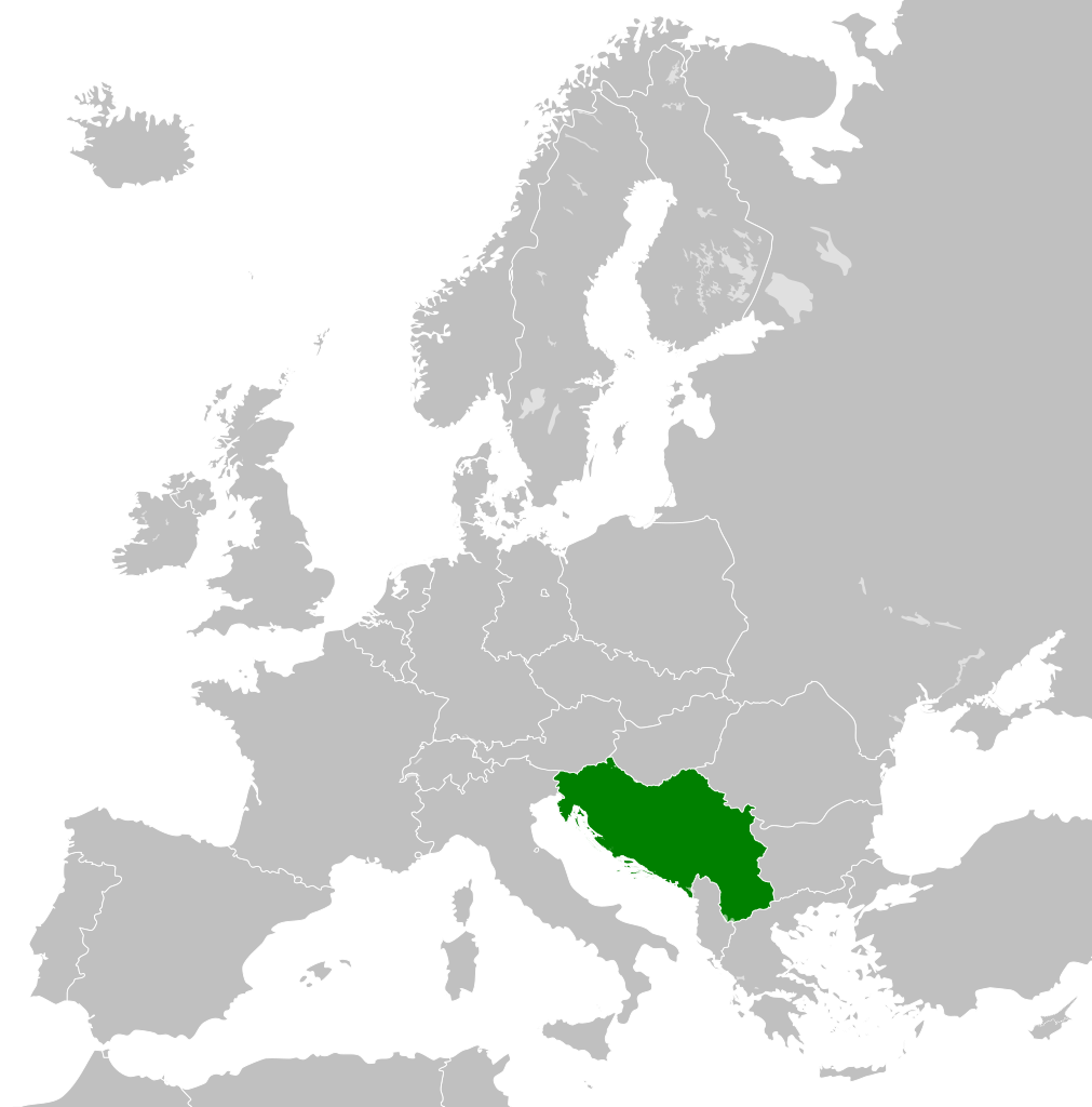
| موجودہ | ۰۶:۰۰, ۲۶ نومبر ۲۰۱۱ | | ۴۵۰ × ۴۵۶ (۴۷۵ کلوبائٹ) | StalwartUK | == {{int:filedesc}} == {{Information |Description={{en|Map of Socialist Federal Republic of Yugoslavia as it was from 1945-1992. Surrounding countries accurate from 1956-1990.}} |Source=*[[:File:Blank_map_o |
فائل دی ورتوں
تھلے دتے گئے 2 صفحے اس فائل نال جُڑدے نیں
فائل ویاپک ورتوں
ایہہ دوجے وکیاں ایس فائل نوں ورتدے نیں –
- ar.wikipedia.org تے ورتوں
- arz.wikipedia.org تے ورتوں
- ast.wikipedia.org تے ورتوں
- ast.wiktionary.org تے ورتوں
- azb.wikipedia.org تے ورتوں
- az.wikipedia.org تے ورتوں
- az.wiktionary.org تے ورتوں
- be-tarask.wikipedia.org تے ورتوں
- be.wikipedia.org تے ورتوں
- bg.wikipedia.org تے ورتوں
- bs.wikipedia.org تے ورتوں
- ca.wikipedia.org تے ورتوں
- ce.wikipedia.org تے ورتوں
- cs.wikipedia.org تے ورتوں
- da.wikipedia.org تے ورتوں
- de.wikipedia.org تے ورتوں
- en.wikipedia.org تے ورتوں
- Socialist Federal Republic of Yugoslavia
- User:Mr Hall of England/sandbox
- Telephone numbers in Yugoslavia
- User:Falcaorib
- Soviet involvement in regime change
- User:XP6287/sandbox
- Guyana–Yugoslavia relations
- Cyprus–Yugoslavia relations
- Afghanistan–Yugoslavia relations
- Pakistan–Yugoslavia relations
- Canada–Yugoslavia relations
- Malta–Yugoslavia relations
- Germany–Yugoslavia relations
- Nicaragua–Yugoslavia relations
- Brazil–Yugoslavia relations
- Cambodia–Yugoslavia relations
- List of companies of the Socialist Federal Republic of Yugoslavia
- en.wiktionary.org تے ورتوں
- es.wikipedia.org تے ورتوں
- es.wiktionary.org تے ورتوں
- eu.wikipedia.org تے ورتوں
- fa.wikipedia.org تے ورتوں
- fi.wikipedia.org تے ورتوں
- fo.wikipedia.org تے ورتوں
- frr.wikipedia.org تے ورتوں
- fr.wikipedia.org تے ورتوں
ایس فائل دا ویکھو ہور جگت ورتن .