فائل:Uttarakhand locator map.svg

Size of this PNG preview of this SVG file: ۶۶۶ × ۵۹۹ پکسلز. دوجے ریزولوشنز: ۲۶۷ × ۲۴۰ پکسلز | ۵۳۳ × ۴۸۰ پکسلز | ۸۵۳ × ۷۶۸ پکسلز | ۱,۱۳۸ × ۱,۰۲۴ پکسلز | ۲,۲۷۶ × ۲,۰۴۸ پکسلز | ۱,۲۵۰ × ۱,۱۲۵ پکسلز ۔
اصل فائل (ایس وی جی فائل، پکسل:۱,۲۵۰ × ۱,۱۲۵، فائل سائز: ۱۳۷ کلوبائٹ)
خلاصہ
| تفصیل |
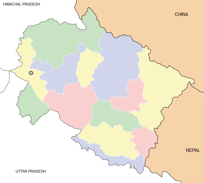
English: Locator map for the state of w:Uttarakhand. Equirectangular projection. Geographic limits of the map: top=31.61, bottom=28.50, left=77.46, right=81.19. |
| تریخ | |
| سروت | آپݨا کم |
| لکھاری | Mkeranat |
لائسنس –
میں، اس کم دے کاپیرائٹ دا مالک، اس کم نوں اس لائسنس دے مطابق چھاپدا واں:

|
کاپی کرن، ونڈن تے بدلن دی ایس ڈوکومنٹ لئی اجازت دتی جاندی اے ایہناں GNU Free Documentation License, Version 1.2 شرطاں نال یا مگروں کسے وی چھپے ورین Free Software Foundation توں بنا کسے انویرینٹ سیکشن دے، ناں فرنٹ کور لکھت تے ناں بیک کور لکھت دے۔ لسنس دی اک کاپی سیکشن وچ ہیگی اے جہدا ناں اے GNU Free Documentation License۔ |
ایس فائل نوں کریٹو کامنز Attribution 3.0 انپورٹڈ لائسنس دتا گیا.
- تہانوں کھلھ اے:
- حصہ کرنا – کاپی، ونڈنا تے کم بھیجنا
- فیر رلانا – کم نوں فٹ کرنا
- تھلے دتیاں شرطاں نال:
- کس دے ناں – تسیں لازمی ایس کم دے بناں والے بارے دسو جنج اونے آکھیا اے یا جنج لسنس چ آکھیا گیا ہے۔
تسیں اپنی مرضی دا لائسنس چݨ سکدے اوہ۔
فائل دی تریخ
فائل نو اس ویلے دی حالت وچ ویکھن واسطے تاریخ/ویلے تے کلک کرو۔
| تریخ تے ویلہ | نکی مورت | پاسے | ورتن والا | تیپّݨی کرو | |
|---|---|---|---|---|---|
| موجودہ | ۰۰:۴۸, ۲ مارچ ۲۰۰۸ | | ۱,۲۵۰ × ۱,۱۲۵ (۱۳۷ کلوبائٹ) | Mkeranat~commonswiki | {{Information |Description=Locator map for the state of Uttarakhand updated with white borders for districts |Source=self-made |Date=Feb 2008 |Author= Mkeranat |Permission= |other_versions= }} |
| ۱۸:۰۴, ۱۰ فروری ۲۰۰۸ |  | ۱,۲۵۰ × ۱,۱۲۵ (۱۳۶ کلوبائٹ) | Mkeranat~commonswiki | {{Information |Title=Uttarakhand locator map |Description=Locator map for the state of [w:Uttarakhand]] |Source=self-made |Date=February 2007 |Author= Mkeranat |Permission= |other_versions= }} |
فائل دی ورتوں
تھلے دتے گئے 11 صفحے اس فائل نال جُڑدے نیں
فائل ویاپک ورتوں
ایہہ دوجے وکیاں ایس فائل نوں ورتدے نیں –
- ar.wikipedia.org تے ورتوں
- ast.wikipedia.org تے ورتوں
- as.wikipedia.org تے ورتوں
- awa.wikipedia.org تے ورتوں
- ba.wikipedia.org تے ورتوں
- bh.wikipedia.org تے ورتوں
- bn.wikipedia.org تے ورتوں
- ceb.wikipedia.org تے ورتوں
- de.wikipedia.org تے ورتوں
- en.wikipedia.org تے ورتوں
- es.wikipedia.org تے ورتوں
- fa.wikipedia.org تے ورتوں
- gu.wikipedia.org تے ورتوں
- hi.wikipedia.org تے ورتوں
ایس فائل دا ویکھو ہور جگت ورتن .