فائل:Turkey in Europe and Greece.jpg
ایس وکھالے دا ناپ: ۴۵۶ × ۶۰۰ پکسلز۔ دوجے ریزولوشنز: ۱۸۲ × ۲۴۰ پکسلز | ۳۶۵ × ۴۸۰ پکسلز | ۵۸۴ × ۷۶۸ پکسلز | ۷۷۸ × ۱,۰۲۴ پکسلز | ۱,۵۵۶ × ۲,۰۴۸ پکسلز | ۳,۸۰۰ × ۵,۰۰۰ پکسلز ۔
اصل فائل (۳,۸۰۰ × ۵,۰۰۰ پکسلز, فائل حجم: ۳.۳۸ میگابائٹ, MIME type: image/jpeg)
خلاصہ
| تفصیل |
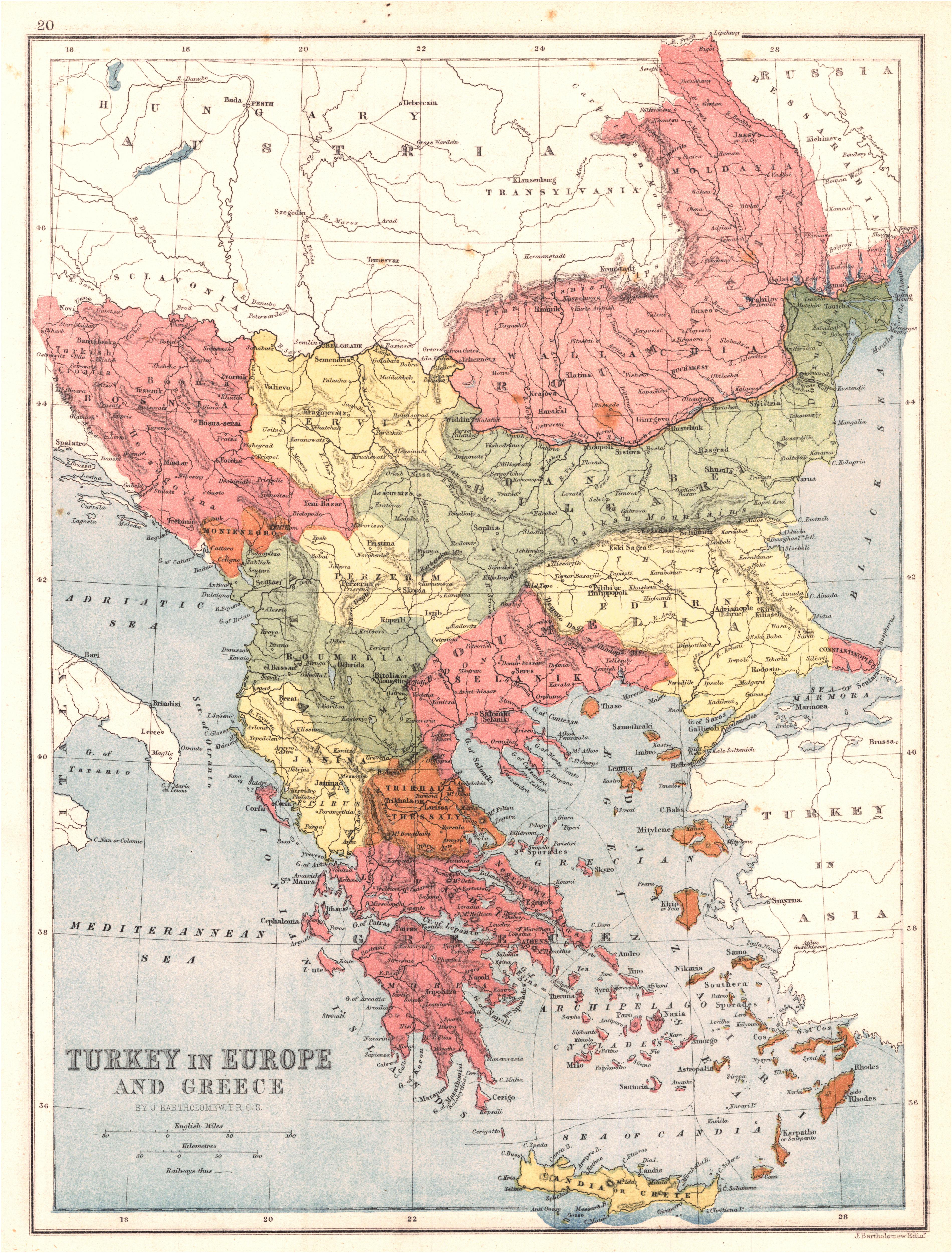
English: Turkey in Europe and Greece
|
| تریخ | |
| سروت | University of Alabama Map Library |
| لکھاری | Bartholomew, John |
لائسنس –
This media file is in the public domain in the United States. This applies to U.S. works where the copyright has expired, often because its first publication occurred prior to January 1, 1929, and if not then due to lack of notice or renewal. See this page for further explanation.
|
 | |
 |
This image might not be in the public domain outside of the United States; this especially applies in the countries and areas that do not apply the rule of the shorter term for US works, such as Canada, Mainland China (not Hong Kong or Macao), Germany, Mexico, and Switzerland. The creator and year of publication are essential information and must be provided. See Wikipedia:Public domain and Wikipedia:Copyrights for more details.
|
| Annotations | This image is annotated: View the annotations at Commons |
فائل دی تریخ
فائل نو اس ویلے دی حالت وچ ویکھن واسطے تاریخ/ویلے تے کلک کرو۔
| تریخ تے ویلہ | نکی مورت | پاسے | ورتن والا | تیپّݨی کرو | |
|---|---|---|---|---|---|
| موجودہ | ۱۶:۲۰, ۲۹ ستمبر ۲۰۱۱ | | ۳,۸۰۰ × ۵,۰۰۰ (۳.۳۸ میگابائٹ) | Underlying lk |
فائل دی ورتوں
تھلے دتے گئے 1 صفحے اس فائل نال جُڑدے نیں
فائل ویاپک ورتوں
ایہہ دوجے وکیاں ایس فائل نوں ورتدے نیں –
- ar.wikipedia.org تے ورتوں
- arz.wikipedia.org تے ورتوں
- de.wikipedia.org تے ورتوں
- en.wikipedia.org تے ورتوں
- et.wikipedia.org تے ورتوں
- id.wikipedia.org تے ورتوں
- it.wikipedia.org تے ورتوں
- ja.wikipedia.org تے ورتوں
- ms.wikipedia.org تے ورتوں
- ro.wikipedia.org تے ورتوں
- sh.wikipedia.org تے ورتوں
- sq.wikipedia.org تے ورتوں
- ur.wikipedia.org تے ورتوں
- zh.wikipedia.org تے ورتوں