فائل:Tanzania relief location map.svg

Size of this PNG preview of this SVG file: ۶۳۰ × ۶۰۰ پکسلز. دوجے ریزولوشنز: ۲۵۲ × ۲۴۰ پکسلز | ۵۰۴ × ۴۸۰ پکسلز | ۸۰۷ × ۷۶۸ پکسلز | ۱,۰۷۶ × ۱,۰۲۴ پکسلز | ۲,۱۵۲ × ۲,۰۴۸ پکسلز | ۳,۳۰۲ × ۳,۱۴۳ پکسلز ۔
اصل فائل (ایس وی جی فائل، پکسل:۳,۳۰۲ × ۳,۱۴۳، فائل سائز: ۳.۱ میگابائٹ)
خلاصہ
| تفصیل |
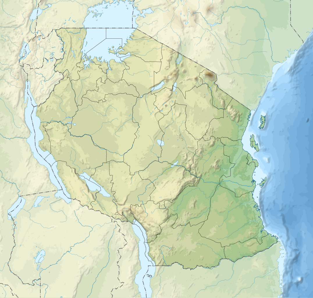
English: Relief location map of Tanzania.
Equirectangular projection. 1° N, 28° W, 42° E, -13° S. Center : -6.375, 35 Español: Mapa de georreferenciación de Tanzania. 1° N, 28° O, 42° E, -13° S. Centro : -6.375, 35
Français : Carte de géolocalisation du relief de la Tanzanie. Projection cylindrique équidistante. 1° N, 28° O, 42° E, -13° S. Centre : -6.375, 35 |
||
| تریخ | (UTC) | ||
| سروت | Derived from Tanzania_map-fr.svg | ||
| لکھاری | Sémhur | ||
| دوجے ورژن |
[]
| ||
| کس دے ناں (required by the license) | © Sémhur / Wikimedia Commons / | ||
| SVG | W3C-validity not checked.
|
||
| Graphic Lab |


| Object location | | View this and other nearby images on: OpenStreetMap |
|---|
لائسنس –
میں، اس کم دے کاپیرائٹ دا مالک، اس کم نوں اس لائسنس دے مطابق چھاپدا واں:
| کاپی حق چھڈیا: آرٹ دا ایہ کم کھلا اے؛ تسیں اینوں ونڈ سکدے او یا بدل سکدے او Free Art License دیاں شرطاں نال۔ تسیں ایدے لسنس دی اک ادھارن Copyleft Attitude site تے Copyleft Attitude site تے ہور سائیٹاں تے لب سکدے او |
This file is licensed under the Creative Commons Attribution-Share Alike 4.0 International, 3.0 Unported, 2.5 Generic, 2.0 Generic and 1.0 Generic license.
- تہانوں کھلھ اے:
- حصہ کرنا – کاپی، ونڈنا تے کم بھیجنا
- فیر رلانا – کم نوں فٹ کرنا
- تھلے دتیاں شرطاں نال:
- کس دے ناں – تسیں لازمی ایس کم دے بناں والے بارے دسو جنج اونے آکھیا اے یا جنج لسنس چ آکھیا گیا ہے۔
- اکو جہا شئیر کرو۔ – اگر تسیں بدلدے یا ایس کم تے بناندے تے بنن والے کم نوں اینج دے لسنس نال ای ونڈو گے۔
تسیں اپنی مرضی دا لائسنس چݨ سکدے اوہ۔
پہلا اپلوڈ دا ریکارڈ
This image is a derivative work of the following images:
- File:Tanzania_map-fr.svg licensed with Cc-by-sa-3.0,2.5,2.0,1.0, GFDL
- 2009-03-20T13:30:18Z Sémhur 3096x3113 (3225659 Bytes) Ol Doinyo Lengaï was misplaced
- 2009-03-20T11:14:35Z Sémhur 3096x3113 (3224368 Bytes) Add location map and few summits.
- 2009-03-19T17:14:13Z Sémhur 3096x3113 (3099209 Bytes) grrr...
- 2009-03-19T17:08:18Z Sémhur 3096x3113 (3099244 Bytes) Oups ! It wasn't the valid one.
- 2009-03-19T17:05:02Z Sémhur 3096x3113 (3122421 Bytes) {{Information |Description={{en|1=Map of [[:en:Tanzania]].}} {{fr|1=Carte de la [[:fr:Tanzanie]].}} {{es|1=Mapa de [[:es:Tanzania]].}} |Source=travail personnel (own work). Sources of data: * Elevations : NASA SRTM3 (public d
Uploaded with derivativeFX
فائل دی تریخ
فائل نو اس ویلے دی حالت وچ ویکھن واسطے تاریخ/ویلے تے کلک کرو۔
| تریخ تے ویلہ | نکی مورت | پاسے | ورتن والا | تیپّݨی کرو | |
|---|---|---|---|---|---|
| موجودہ | ۰۱:۳۲, ۴ مارچ ۲۰۲۰ | | ۳,۳۰۲ × ۳,۱۴۳ (۳.۱ میگابائٹ) | Sémhur | Modifying Tanzanian border claim (from https://www.nbs.go.tz/index.php/en/census-surveys/gis/385-2012-phc-shapefiles-level-one-and-two) |
| ۰۱:۱۸, ۲۹ جون ۲۰۱۷ |  | ۳,۳۰۲ × ۳,۱۴۳ (۳.۰۹ میگابائٹ) | Sémhur | Update with Songwe region | |
| ۱۹:۱۱, ۲۸ دسمبر ۲۰۱۳ |  | ۳,۰۹۶ × ۲,۹۴۷ (۳.۱ میگابائٹ) | Sémhur | Updated with the four new regions | |
| ۲۰:۱۷, ۳ مئی ۲۰۰۹ |  | ۳,۰۹۶ × ۲,۹۴۷ (۳.۵۵ میگابائٹ) | Sémhur | Adding border between Arusha and Manyara | |
| ۲۳:۵۸, ۱ مئی ۲۰۰۹ |  | ۳,۰۹۶ × ۲,۹۴۷ (۳.۵۴ میگابائٹ) | Sémhur | {{int:summary}} {{Information |Description={{en|1=Relief location map of en:Tanzania.}} {{fr|1=Carte de géolocalisation du relief de la fr:Tanzanie.}} {{es|1=Mapa de georreferenciación de es:Tanzania.}} Equirectangular projection. 0.25� |
فائل دی ورتوں
تھلے دتے گئے 9 صفحے اس فائل نال جُڑدے نیں
فائل ویاپک ورتوں
ایہہ دوجے وکیاں ایس فائل نوں ورتدے نیں –
- af.wikipedia.org تے ورتوں
- als.wikipedia.org تے ورتوں
- ar.wikipedia.org تے ورتوں
- ast.wikipedia.org تے ورتوں
- as.wikipedia.org تے ورتوں
- avk.wikipedia.org تے ورتوں
- av.wikipedia.org تے ورتوں
- azb.wikipedia.org تے ورتوں
- az.wikipedia.org تے ورتوں
- ban.wikipedia.org تے ورتوں
- ba.wikipedia.org تے ورتوں
ایس فائل دا ویکھو ہور جگت ورتن .