فائل:Tabar south.jpg
ایس وکھالے دا ناپ: ۸۰۰ × ۴۸۸ پکسلز۔ دوجے ریزولوشنز: ۳۲۰ × ۱۹۵ پکسلز | ۶۴۰ × ۳۹۰ پکسلز | ۱,۰۰۰ × ۶۱۰ پکسلز ۔
اصل فائل (۱,۰۰۰ × ۶۱۰ پکسلز, فائل حجم: ۱۰۹ کلوبائٹ, MIME type: image/jpeg)
خلاصہ
| تفصیل |
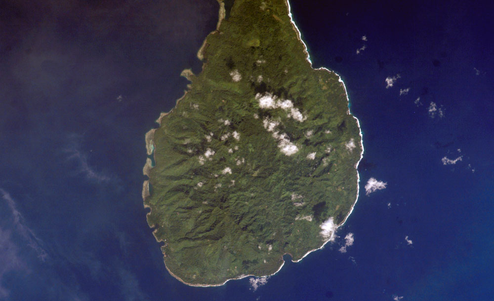
English: South part of Tabar island, PNG
Русский: Южная часть острова Табар, Папуа - Новая Гвинея |
| تریخ | |
| سروت | http://www.oceandots.com/pacific/png/tabar-south.php |
| لکھاری | earth sciences and image analysis laboratory |
لائسنس –
| This file is in the public domain in the United States because it was solely created by NASA. NASA copyright policy states that "NASA material is not protected by copyright unless noted". (See Template:PD-USGov, NASA copyright policy page or JPL Image Use Policy.) | ||
 |
Warnings:
|
فائل دی تریخ
فائل نو اس ویلے دی حالت وچ ویکھن واسطے تاریخ/ویلے تے کلک کرو۔
| تریخ تے ویلہ | نکی مورت | پاسے | ورتن والا | تیپّݨی کرو | |
|---|---|---|---|---|---|
| موجودہ | ۱۲:۴۷, ۱۰ اپریل ۲۰۱۰ | | ۱,۰۰۰ × ۶۱۰ (۱۰۹ کلوبائٹ) | Boodjoom85 | {{Information |Description={{en|1=South part of Tabar island, PNG}} {{ru|1=Южная часть острова Табар, Папуа - Новая Гвинея}} |Source=http://www.oceandots.com/pacific/png/tabar-south.php |Author=earth sciences and imag |
فائل دی ورتوں
تھلے دتے گئے 1 صفحے اس فائل نال جُڑدے نیں
فائل ویاپک ورتوں
ایہہ دوجے وکیاں ایس فائل نوں ورتدے نیں –
- ceb.wikipedia.org تے ورتوں
- de.wikipedia.org تے ورتوں
- en.wikipedia.org تے ورتوں
- it.wikipedia.org تے ورتوں
- ka.wikipedia.org تے ورتوں
- mrj.wikipedia.org تے ورتوں
- nl.wikipedia.org تے ورتوں
- www.wikidata.org تے ورتوں
- zh.wikipedia.org تے ورتوں