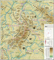
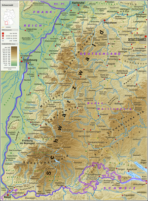
فائل:Schwäbische Alb - Deutsche Mittelgebirge, Serie A-de.png

ایس وکھالے دا ناپ: ۷۹۲ × ۶۰۰ پکسلز۔ دوجے ریزولوشنز: ۳۱۷ × ۲۴۰ پکسلز | ۶۳۴ × ۴۸۰ پکسلز | ۱,۰۱۴ × ۷۶۸ پکسلز | ۱,۲۸۰ × ۹۶۹ پکسلز | ۲,۵۶۰ × ۱,۹۳۸ پکسلز | ۳,۵۰۰ × ۲,۶۵۰ پکسلز ۔
اصل فائل (۳,۵۰۰ × ۲,۶۵۰ پکسلز, فائل حجم: ۱۳.۰۵ میگابائٹ, MIME type: image/png)
فائل دی تریخ
فائل نو اس ویلے دی حالت وچ ویکھن واسطے تاریخ/ویلے تے کلک کرو۔
| تریخ تے ویلہ | نکی مورت | پاسے | ورتن والا | تیپّݨی کرو | |
|---|---|---|---|---|---|
| موجودہ | ۰۱:۲۸, ۱۱ مارچ ۲۰۲۲ |  | ۳,۵۰۰ × ۲,۶۵۰ (۱۳.۰۵ میگابائٹ) | Thoroe | Taiflingen -> Tailfingen |
| ۱۸:۱۰, ۲۱ جنوری ۲۰۱۹ |  | ۳,۵۰۰ × ۲,۶۵۰ (۱۳.۰۵ میگابائٹ) | Thoroe | Einwohnerzahl Mössingen | |
| ۰۱:۲۴, ۸ فروری ۲۰۱۷ |  | ۳,۵۰۰ × ۲,۶۵۰ (۱۳.۴۸ میگابائٹ) | Thoroe | minor fixes | |
| ۰۲:۵۶, ۷ فروری ۲۰۱۷ |  | ۳,۵۰۰ × ۲,۶۵۰ (۱۳.۴۷ میگابائٹ) | Thoroe | several additions | |
| ۱۸:۴۹, ۴ فروری ۲۰۱۷ |  | ۳,۴۵۰ × ۲,۶۰۰ (۱۲.۹۶ میگابائٹ) | Thoroe | {{Information |Description ={{en|1=Topographic map of the Swabian Jura}} {{de|1=Topografische Karte der Schwäbischen Alb}} |Source ={{Own using}} *[http://gmt.soest.hawaii.edu Generic Mapping To... |
فائل دی ورتوں
تھلے دتے گئے 1 صفحے اس فائل نال جُڑدے نیں
فائل ویاپک ورتوں
ایہہ دوجے وکیاں ایس فائل نوں ورتدے نیں –
- af.wikipedia.org تے ورتوں
- bg.wikipedia.org تے ورتوں
- cs.wikipedia.org تے ورتوں
- de.wikipedia.org تے ورتوں
- Schwäbische Alb
- Albtrauf
- Großer Heuberg
- Diskussion:Albtrauf
- Benutzer:Thoroe
- Ostalb
- Wikipedia:Kartenwerkstatt/Karte des Tages/Galerie
- Geologie der Fränkischen Alb
- Portal:Schwäbische Alb
- Benutzer:Holger1959/BW-1
- Wikipedia:Kartenwerkstatt/Archiv/2017-02
- Benutzer:Thoroe/Making of Thüringer Wald
- Westalb
- Benutzer:Triplec85/BW-1
- de.wiktionary.org تے ورتوں
- en.wikipedia.org تے ورتوں
- eo.wikipedia.org تے ورتوں
- es.wikipedia.org تے ورتوں
- fi.wikipedia.org تے ورتوں
- frr.wikipedia.org تے ورتوں
- fr.wikipedia.org تے ورتوں
- fr.wiktionary.org تے ورتوں
- hr.wikipedia.org تے ورتوں
- hu.wikipedia.org تے ورتوں
- nl.wikipedia.org تے ورتوں
- no.wikipedia.org تے ورتوں
- pl.wikipedia.org تے ورتوں
- pl.wikivoyage.org تے ورتوں
- pt.wikipedia.org تے ورتوں
- ro.wikipedia.org تے ورتوں
- sk.wikipedia.org تے ورتوں
- sl.wikipedia.org تے ورتوں
- sv.wikipedia.org تے ورتوں
- uk.wikipedia.org تے ورتوں
- www.wikidata.org تے ورتوں


