فائل:Persia 1814.jpg
ایس وکھالے دا ناپ: ۷۱۸ × ۶۰۰ پکسلز۔ دوجے ریزولوشنز: ۲۸۷ × ۲۴۰ پکسلز | ۵۷۵ × ۴۸۰ پکسلز | ۹۲۰ × ۷۶۸ پکسلز | ۱,۲۲۶ × ۱,۰۲۴ پکسلز | ۲,۴۵۲ × ۲,۰۴۸ پکسلز | ۲,۹۳۱ × ۲,۴۴۸ پکسلز ۔
اصل فائل (۲,۹۳۱ × ۲,۴۴۸ پکسلز, فائل حجم: ۱.۶ میگابائٹ, MIME type: image/jpeg)
خلاصہ
| Description |
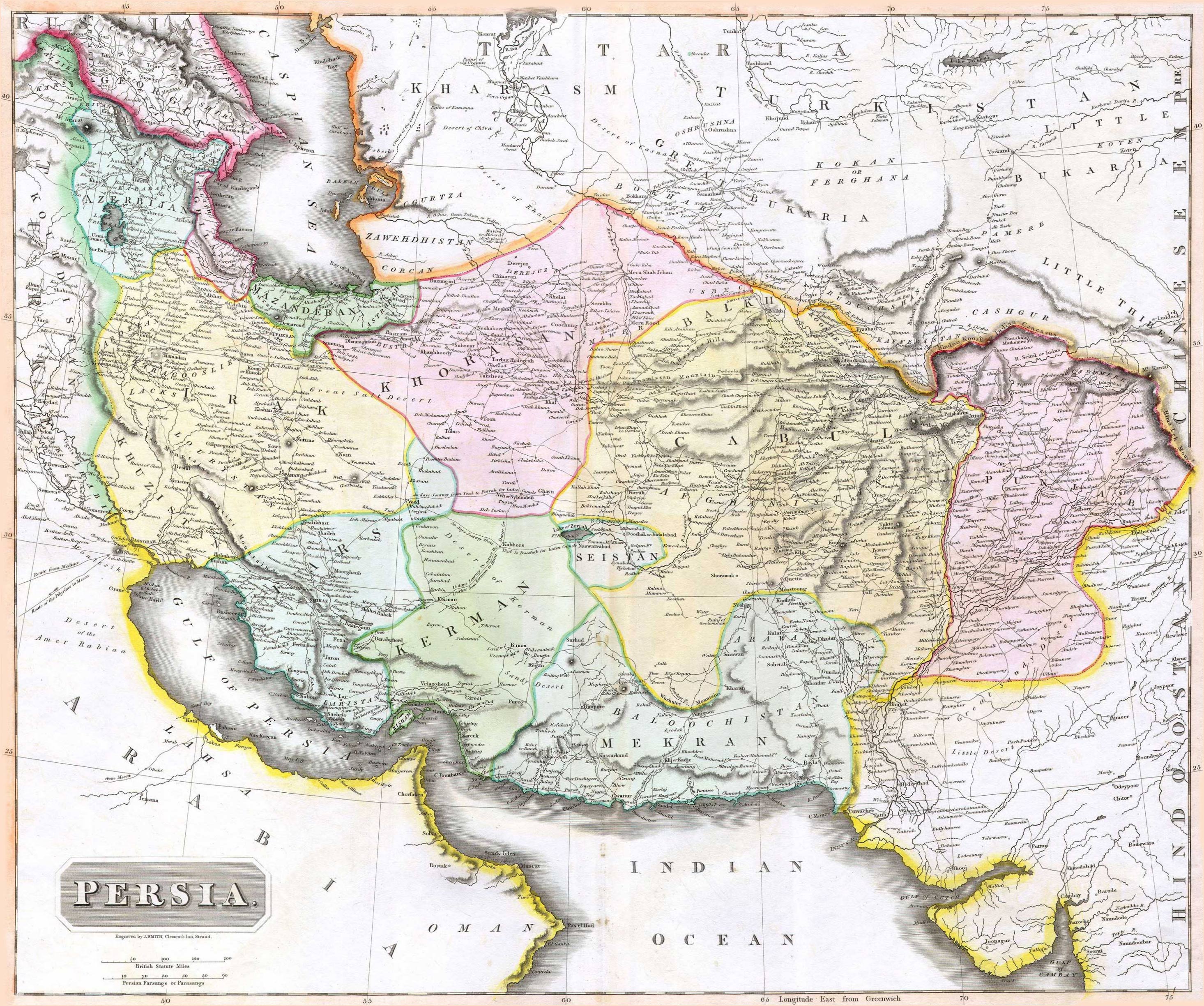
English: 1814 Thomson Map of Persia (Iran), engraved by J. Smith, Clement's Inn, Strand. |
| تریخ | |
| Creator |
J. Smith, Clement's Inn, Strand. |
| Geotemporal data | |
| Map location | Iran |
| Georeferencing | If inappropriate please set warp_status = skip to hide. |
| Bibliographic data | |
| Publication |
New General Atlas (1821) |
| لکھاری |
John Thomson |
| دوجے ورژن | |

لائسنس –
The copyright situation of this work is theoretically uncertain, because in the country of origin copyright lasts 70 years after the death of the author, and the date of the author's death is unknown. However, the date of creation of the work was over 120 years ago, and it is thus a reasonable assumption that the copyright has expired (see here for the community discussion). Do not use this template if the date of death of the author is known.
This work is in the public domain in the United States because it was published (or registered with the U.S. Copyright Office) before January 1, 1929. | |
| ایہ فائل دے بارے چ دس اے جے اے کاپی حف دیاں روکاں توں کھلی اے تے نالدے رلدے حقاں توں وی۔ | |
فائل دی تریخ
فائل نو اس ویلے دی حالت وچ ویکھن واسطے تاریخ/ویلے تے کلک کرو۔
| تریخ تے ویلہ | نکی مورت | پاسے | ورتن والا | تیپّݨی کرو | |
|---|---|---|---|---|---|
| موجودہ | ۱۲:۲۷, ۱۸ اگست ۲۰۱۰ | | ۲,۹۳۱ × ۲,۴۴۸ (۱.۶ میگابائٹ) | Begoon | edge perspective and crop |
| ۰۷:۳۵, ۱۹ نومبر ۲۰۰۶ |  | ۲,۹۷۹ × ۲,۵۲۰ (۱.۴۵ میگابائٹ) | Kaveh | == Summary == 1814 Thomson Map of Persia (Iran) Category:Maps of Iran == Licensing == {{PD-old}} |
فائل دی ورتوں
تھلے دتے گئے 2 صفحے اس فائل نال جُڑدے نیں
فائل ویاپک ورتوں
ایہہ دوجے وکیاں ایس فائل نوں ورتدے نیں –
- ar.wikipedia.org تے ورتوں
- az.wikipedia.org تے ورتوں
- be.wikipedia.org تے ورتوں
- bn.wikipedia.org تے ورتوں
- bs.wikipedia.org تے ورتوں
- ca.wikipedia.org تے ورتوں
- da.wikipedia.org تے ورتوں
- de.wikipedia.org تے ورتوں
- en.wikipedia.org تے ورتوں
- es.wikipedia.org تے ورتوں
- eu.wikipedia.org تے ورتوں
- fa.wikipedia.org تے ورتوں
- fr.wikipedia.org تے ورتوں
- hi.wikipedia.org تے ورتوں
- hr.wikipedia.org تے ورتوں
ایس فائل دا ویکھو ہور جگت ورتن .