فائل:Myanmar location map.svg

Size of this PNG preview of this SVG file: ۲۸۵ × ۵۹۹ پکسلز. دوجے ریزولوشنز: ۱۱۴ × ۲۴۰ پکسلز | ۲۲۸ × ۴۸۰ پکسلز | ۳۶۵ × ۷۶۸ پکسلز | ۴۸۷ × ۱,۰۲۴ پکسلز | ۹۷۵ × ۲,۰۴۸ پکسلز | ۱,۲۰۰ × ۲,۵۲۰ پکسلز ۔
اصل فائل (ایس وی جی فائل، پکسل:۱,۲۰۰ × ۲,۵۲۰، فائل سائز: ۶۳۳ کلوبائٹ)
خلاصہ
| تفصیل |
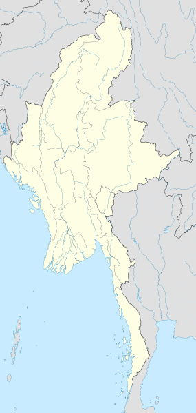
English: Location map of Myanmar. Equirectangular projection. Strechted by 105.0%. Geographic limits of the map: * N: 29.0° N * S: 9.0° N * W: 92.0° E * E: 102.0° E Made with Natural Earth. Free vector and raster map data @ naturalearthdata.com. |
| تریخ | |
| سروت | آپݨا کم |
| لکھاری | Uwe Dedering |
لائسنس –
میں، اس کم دے کاپیرائٹ دا مالک، اس کم نوں اس لائسنس دے مطابق چھاپدا واں:
ایس فائل نوں کریٹو کامنز Attribution 2.5 پولینڈ لائسنس دتا گیا.
- تہانوں کھلھ اے:
- حصہ کرنا – کاپی، ونڈنا تے کم بھیجنا
- فیر رلانا – کم نوں فٹ کرنا
- تھلے دتیاں شرطاں نال:
- کس دے ناں – تسیں لازمی ایس کم دے بناں والے بارے دسو جنج اونے آکھیا اے یا جنج لسنس چ آکھیا گیا ہے۔
- اکو جہا شئیر کرو۔ – اگر تسیں بدلدے یا ایس کم تے بناندے تے بنن والے کم نوں اینج دے لسنس نال ای ونڈو گے۔

|
کاپی کرن، ونڈن تے بدلن دی ایس ڈوکومنٹ لئی اجازت دتی جاندی اے ایہناں GNU Free Documentation License, Version 1.2 شرطاں نال یا مگروں کسے وی چھپے ورین Free Software Foundation توں بنا کسے انویرینٹ سیکشن دے، ناں فرنٹ کور لکھت تے ناں بیک کور لکھت دے۔ لسنس دی اک کاپی سیکشن وچ ہیگی اے جہدا ناں اے GNU Free Documentation License۔ |
تسیں اپنی مرضی دا لائسنس چݨ سکدے اوہ۔
| Annotations | This image is annotated: View the annotations at Commons |
فائل دی تریخ
فائل نو اس ویلے دی حالت وچ ویکھن واسطے تاریخ/ویلے تے کلک کرو۔
| تریخ تے ویلہ | نکی مورت | پاسے | ورتن والا | تیپّݨی کرو | |
|---|---|---|---|---|---|
| موجودہ | ۲۱:۰۸, ۲۹ ستمبر ۲۰۱۱ | | ۱,۲۰۰ × ۲,۵۲۰ (۶۳۳ کلوبائٹ) | NordNordWest | corr, see disk |
| ۲۲:۴۵, ۱۸ فروری ۲۰۱۰ |  | ۱,۲۰۰ × ۲,۵۲۰ (۹۶۸ کلوبائٹ) | Uwe Dedering | no disputed countries | |
| ۱۸:۰۳, ۱۸ فروری ۲۰۱۰ |  | ۱,۲۰۰ × ۲,۵۲۰ (۹۷۴ کلوبائٹ) | Uwe Dedering | {{Information |Description={{en|1=Location map of Myanmar. Equirectangular projection. Strechted by 105.0%. Geographic limits of the map: * N: 29.0° N * S: 9.0° N * W: 92.0° E * E: 102.0° E Made with Natural Earth. Free vector and raster map dat |
فائل دی ورتوں
تھلے دتے گئے 1 صفحے اس فائل نال جُڑدے نیں
فائل ویاپک ورتوں
ایہہ دوجے وکیاں ایس فائل نوں ورتدے نیں –
- af.wikipedia.org تے ورتوں
- an.wikipedia.org تے ورتوں
- ar.wikipedia.org تے ورتوں
- az.wikipedia.org تے ورتوں
- ba.wikipedia.org تے ورتوں
- be.wikipedia.org تے ورتوں
- bg.wikipedia.org تے ورتوں
- bh.wikipedia.org تے ورتوں
- bn.wikipedia.org تے ورتوں
ایس فائل دا ویکھو ہور جگت ورتن .