فائل:Mediterranean Sea political map-es.svg

Size of this PNG preview of this SVG file: ۸۰۰ × ۵۸۵ پکسلز. دوجے ریزولوشنز: ۳۲۰ × ۲۳۴ پکسلز | ۶۴۰ × ۴۶۸ پکسلز | ۱,۰۲۴ × ۷۴۹ پکسلز | ۱,۲۸۰ × ۹۳۶ پکسلز | ۲,۵۶۰ × ۱,۸۷۲ پکسلز | ۲,۰۴۶ × ۱,۴۹۶ پکسلز ۔
اصل فائل (ایس وی جی فائل، پکسل:۲,۰۴۶ × ۱,۴۹۶، فائل سائز: ۱.۱ میگابائٹ)
| تفصیل |
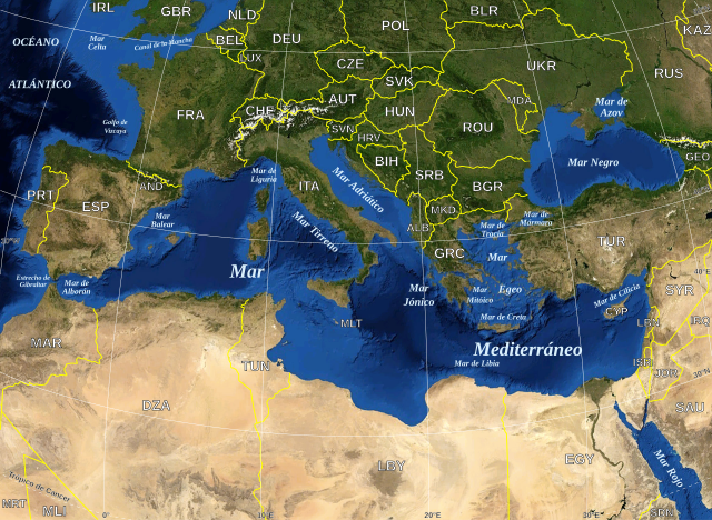
English: Map in Spanish of the Mediterranean Sea, with the borders and the name of the States following the ISO 3166-1 Alpha-3 code. Español: Mapa en español del Mar Mediterraneo con las fronteras y los nombres de los estados siguiendo el código ISO 3166-1 Alpha-3. |
| تریخ | (UTC) |
| سروت | |
| لکھاری |
|
| This is a retouched picture, which means that it has been digitally altered from its original version. Modifications: Versión en español. The original can be viewed here: Mediterranean Sea political map-en.svg:
|
| This image is in the public domain because it is a screenshot from NASA’s globe software World Wind using a public domain layer, such as Blue Marble, MODIS, Landsat, SRTM, USGS or GLOBE.
|
 |
| This work was previously under Public Domain, or a Free License. It has been digitally enhanced and/or modified. This derivative work has been (or is hereby) released into the public domain by its author, [[:{{{1}}}:User:{{{3}}}|{{{3}}}]] at the [[:{{{1}}}:|{{{2}}}]] project. This applies worldwide. In some countries this is not legally possible; if so:
|
پہلا اپلوڈ دا ریکارڈ
This image is a derivative work of the following images:
- File:Mediterranean_Sea_political_map-en.svg licensed with PD-WorldWind, PD-retouched-user-w
- 2008-05-19T16:18:12Z Sting 2046x1496 (1148854 Bytes) "Tropic of Cancer" label correction
- 2007-06-21T01:01:36Z Sting 2046x1496 (1148419 Bytes) {{Information |Description=Map in English of the [[:en:Mediterranean Sea|Mediterranean Sea]], with the borders and the name of the States following the ISO 3166-1 Alpha-3 code. |Source=Own work ;Background map : screenshot fr
Uploaded with derivativeFX
فائل دی تریخ
فائل نو اس ویلے دی حالت وچ ویکھن واسطے تاریخ/ویلے تے کلک کرو۔
| تریخ تے ویلہ | نکی مورت | پاسے | ورتن والا | تیپّݨی کرو | |
|---|---|---|---|---|---|
| موجودہ | ۲۳:۳۲, ۱۳ جون ۲۰۱۰ | | ۲,۰۴۶ × ۱,۴۹۶ (۱.۱ میگابائٹ) | Edoarado | Corregido error en "Océano Atlántico", el texto aparecía del revés. |
| ۲۳:۱۶, ۱۳ جون ۲۰۱۰ |  | ۲,۰۴۶ × ۱,۴۹۶ (۱.۱ میگابائٹ) | Edoarado | {{Information |Description={{en|Map in Spanish of the Mediterranean Sea, with the borders and the name of the States following the ISO 3166-1 Alpha-3 code.}} {{es|Mapa en español del Mar Mediterraneo con |
فائل دی ورتوں
تھلے دتے گئے 1 صفحے اس فائل نال جُڑدے نیں
فائل ویاپک ورتوں
ایہہ دوجے وکیاں ایس فائل نوں ورتدے نیں –
- ar.wikipedia.org تے ورتوں
- arz.wikipedia.org تے ورتوں
- ast.wikipedia.org تے ورتوں
- ca.wikipedia.org تے ورتوں
- el.wikipedia.org تے ورتوں
- en.wikipedia.org تے ورتوں
- es.wikipedia.org تے ورتوں
- eu.wikipedia.org تے ورتوں
- fi.wiktionary.org تے ورتوں
- fr.wikinews.org تے ورتوں
- ga.wikipedia.org تے ورتوں
- gl.wikipedia.org تے ورتوں
- ha.wikipedia.org تے ورتوں
- ia.wikipedia.org تے ورتوں
- kab.wikipedia.org تے ورتوں
- la.wikipedia.org تے ورتوں
- mzn.wikipedia.org تے ورتوں
- pt.wikipedia.org تے ورتوں
- shi.wikipedia.org تے ورتوں
- vec.wikipedia.org تے ورتوں
- www.wikidata.org تے ورتوں