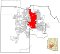
فائل:Maricopa County Incorporated and Planning areas Phoenix highlighted.svg

Size of this PNG preview of this SVG file: ۶۹۴ × ۵۹۹ پکسلز. دوجے ریزولوشنز: ۲۷۸ × ۲۴۰ پکسلز | ۵۵۶ × ۴۸۰ پکسلز | ۸۸۹ × ۷۶۸ پکسلز | ۱,۱۸۵ × ۱,۰۲۴ پکسلز | ۲,۳۷۱ × ۲,۰۴۸ پکسلز | ۹۴۰ × ۸۱۲ پکسلز ۔
اصل فائل (ایس وی جی فائل، پکسل:۹۴۰ × ۸۱۲، فائل سائز: ۱.۰۵ میگابائٹ)
فائل دی تریخ
فائل نو اس ویلے دی حالت وچ ویکھن واسطے تاریخ/ویلے تے کلک کرو۔
| تریخ تے ویلہ | نکی مورت | پاسے | ورتن والا | تیپّݨی کرو | |
|---|---|---|---|---|---|
| موجودہ | ۰۵:۱۴, ۱۴ جولائی ۲۰۲۲ |  | ۹۴۰ × ۸۱۲ (۱.۰۵ میگابائٹ) | EmmaCoop | Cleaning up errors found on validator |
| ۱۲:۱۲, ۱۹ مئی ۲۰۱۱ |  | ۹۴۰ × ۸۱۲ (۱.۱۱ میگابائٹ) | Ixnayonthetimmay | Uploading new version | |
| ۰۹:۳۵, ۳۰ اگست ۲۰۰۸ |  | ۹۰۰ × ۸۰۰ (۴۲۳ کلوبائٹ) | Ixnayonthetimmay | == Summary == {{Information |Description=This map shows the incorporated areas and unincorporated areas in Maricopa County, Arizona. [[:en:Paloma, Arizona|Pa | |
| ۰۴:۵۴, ۱۶ ستمبر ۲۰۰۷ |  | ۹۰۰ × ۸۰۰ (۳۸۴ کلوبائٹ) | Ixnayonthetimmay | == Summary == {{Information |Description=This map shows the incorporated areas in Maricopa County, Arizona. It also shows the boundaries for the municipal planning areas. The [[:en:Fort | |
| ۱۵:۱۱, ۲۸ مئی ۲۰۰۷ |  | ۹۰۰ × ۷۸۰ (۳۲۹ کلوبائٹ) | Ixnayonthetimmay | ||
| ۰۵:۵۵, ۲۲ مئی ۲۰۰۷ |  | ۹۰۰ × ۷۸۰ (۳۱۸ کلوبائٹ) | Ixnayonthetimmay | ||
| ۱۰:۲۲, ۳۰ جنوری ۲۰۰۷ |  | ۹۰۴ × ۷۵۸ (۱۸۹ کلوبائٹ) | Ixnayonthetimmay | {{Information |Description=This map shows the incorporated areas in Maricopa County, Arizona, highlighting Phoenix in red. It also shows the boundaries for the m |
فائل دی ورتوں
تھلے دتے گئے 1 صفحے اس فائل نال جُڑدے نیں
فائل ویاپک ورتوں
ایہہ دوجے وکیاں ایس فائل نوں ورتدے نیں –
- af.wikipedia.org تے ورتوں
- bn.wikipedia.org تے ورتوں
- br.wikipedia.org تے ورتوں
- ceb.wikipedia.org تے ورتوں
- en.wikipedia.org تے ورتوں
- et.wikipedia.org تے ورتوں
- fa.wikipedia.org تے ورتوں
- fi.wikipedia.org تے ورتوں
- fo.wikipedia.org تے ورتوں
- he.wikipedia.org تے ورتوں
- id.wikipedia.org تے ورتوں
- ilo.wikipedia.org تے ورتوں
- ja.wikipedia.org تے ورتوں
- kn.wikipedia.org تے ورتوں
- ko.wikipedia.org تے ورتوں
- kw.wikipedia.org تے ورتوں
- lad.wikipedia.org تے ورتوں
- mi.wikipedia.org تے ورتوں
- ml.wikipedia.org تے ورتوں
- ms.wikipedia.org تے ورتوں
- no.wikipedia.org تے ورتوں
- pam.wikipedia.org تے ورتوں
- ro.wikipedia.org تے ورتوں
- sco.wikipedia.org تے ورتوں
- sk.wikipedia.org تے ورتوں
- sl.wikipedia.org تے ورتوں
- smn.wikipedia.org تے ورتوں
- ta.wikipedia.org تے ورتوں
- te.wikipedia.org تے ورتوں
- tr.wikipedia.org تے ورتوں
- ug.wikipedia.org تے ورتوں
- ur.wikipedia.org تے ورتوں
- vi.wikipedia.org تے ورتوں
- zh-classical.wikipedia.org تے ورتوں
- zh.wikipedia.org تے ورتوں