فائل:Maksimovsky rock Chusovaya river.jpg

ایس وکھالے دا ناپ: ۷۰۳ × ۵۹۹ پکسلز۔ دوجے ریزولوشنز: ۲۸۲ × ۲۴۰ پکسلز | ۵۶۳ × ۴۸۰ پکسلز | ۹۲۸ × ۷۹۱ پکسلز ۔
اصل فائل (۹۲۸ × ۷۹۱ پکسلز, فائل حجم: ۱۳۴ کلوبائٹ, MIME type: image/jpeg)
| تفصیل |
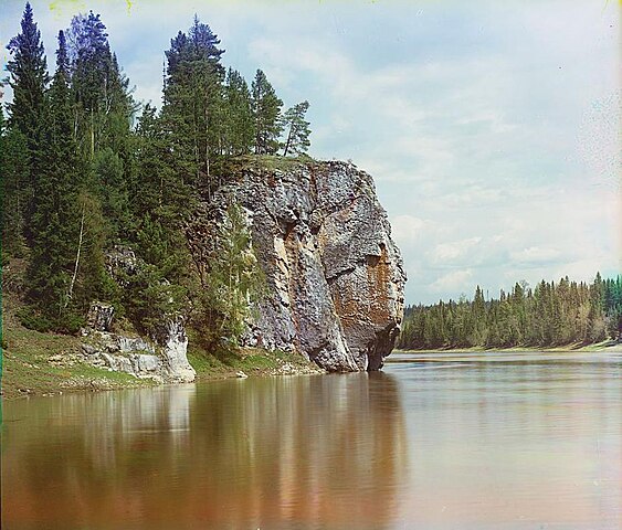
Русский: Максимовский камень около деревни Родина (река Чусовая). |
||||||||||||||||||||
| تریخ | |||||||||||||||||||||
| سروت |
Sergei Mikhailovich Prokudin-Gorskii Collection (Library of Congress)
|
||||||||||||||||||||
| لکھاری |
|
||||||||||||||||||||
| اجازت (فائل نوں دوبارہ ورتنا) |
There are no known restrictions on the use of this image. https://hdl.loc.gov/loc.pnp/res.237.prok | ||||||||||||||||||||


| Camera location | | View this and other nearby images on: OpenStreetMap |
|---|
|
The author died in 1944, so this work is in the public domain in its country of origin and other countries and areas where the copyright term is the author's life plus 75 years or fewer. This work is in the public domain in the United States because it was published (or registered with the U.S. Copyright Office) before January 1, 1929. | |
| ایہ فائل دے بارے چ دس اے جے اے کاپی حف دیاں روکاں توں کھلی اے تے نالدے رلدے حقاں توں وی۔ | |
فائل دی تریخ
فائل نو اس ویلے دی حالت وچ ویکھن واسطے تاریخ/ویلے تے کلک کرو۔
| تریخ تے ویلہ | نکی مورت | پاسے | ورتن والا | تیپّݨی کرو | |
|---|---|---|---|---|---|
| موجودہ | ۱۹:۳۰, ۱۲ جولائی ۲۰۰۵ | | ۹۲۸ × ۷۹۱ (۱۳۴ کلوبائٹ) | Hardscarf | Early color photograph from Russia, created by Sergei Mikhailovich Prokudin-Gorskii as part of his work to document the Russian Empire from 1909 to 1915. The Maksimovsky rock in the river Chusovaya in the [ |
فائل دی ورتوں
تھلے دتے گئے 1 صفحے اس فائل نال جُڑدے نیں
فائل ویاپک ورتوں
ایہہ دوجے وکیاں ایس فائل نوں ورتدے نیں –
- af.wikipedia.org تے ورتوں
- ang.wikipedia.org تے ورتوں
- arz.wikipedia.org تے ورتوں
- ast.wikipedia.org تے ورتوں
- azb.wikipedia.org تے ورتوں
- az.wikipedia.org تے ورتوں
- ba.wikipedia.org تے ورتوں
- be-tarask.wikipedia.org تے ورتوں
- be.wikipedia.org تے ورتوں
- bg.wikipedia.org تے ورتوں
- bxr.wikipedia.org تے ورتوں
- ca.wikipedia.org تے ورتوں
- ceb.wikipedia.org تے ورتوں
- cv.wikipedia.org تے ورتوں
- da.wikipedia.org تے ورتوں
- de.wikipedia.org تے ورتوں
- en.wikipedia.org تے ورتوں
- en.wikivoyage.org تے ورتوں
- eo.wikipedia.org تے ورتوں
- es.wikipedia.org تے ورتوں
- et.wikipedia.org تے ورتوں
- fi.wikipedia.org تے ورتوں
- fr.wikipedia.org تے ورتوں
- he.wikivoyage.org تے ورتوں
- hi.wikipedia.org تے ورتوں
- hr.wikipedia.org تے ورتوں
- hu.wikipedia.org تے ورتوں
- hy.wikipedia.org تے ورتوں
- it.wikipedia.org تے ورتوں
- ja.wikipedia.org تے ورتوں
ایس فائل دا ویکھو ہور جگت ورتن .