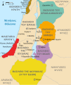
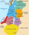
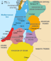
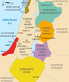
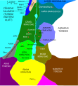
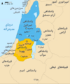
فائل:Kingdoms of Israel and Judah map 830.svg

Size of this PNG preview of this SVG file: ۵۰۲ × ۵۹۹ پکسلز. دوجے ریزولوشنز: ۲۰۱ × ۲۴۰ پکسلز | ۴۰۲ × ۴۸۰ پکسلز | ۶۴۴ × ۷۶۸ پکسلز | ۸۵۸ × ۱,۰۲۴ پکسلز | ۱,۷۱۷ × ۲,۰۴۸ پکسلز | ۷۲۰ × ۸۵۹ پکسلز ۔
اصل فائل (ایس وی جی فائل، پکسل:۷۲۰ × ۸۵۹، فائل سائز: ۹۶ کلوبائٹ)
فائل دی تریخ
فائل نو اس ویلے دی حالت وچ ویکھن واسطے تاریخ/ویلے تے کلک کرو۔
| تریخ تے ویلہ | نکی مورت | پاسے | ورتن والا | تیپّݨی کرو | |
|---|---|---|---|---|---|
| موجودہ | ۱۹:۱۲, ۱ اکتوبر ۲۰۲۱ |  | ۷۲۰ × ۸۵۹ (۹۶ کلوبائٹ) | Sadopaul | File uploaded using svgtranslate tool (https://svgtranslate.toolforge.org/). Added translation for ko. |
| ۲۰:۵۰, ۱۰ فروری ۲۰۱۷ |  | ۷۲۰ × ۸۵۹ (۸۰ کلوبائٹ) | Malus Catulus | removed 'Sizu' - a weird artifact from the Norse original | |
| ۰۴:۴۸, ۱۳ فروری ۲۰۱۱ |  | ۷۲۰ × ۸۵۹ (۷۸ کلوبائٹ) | Malus Catulus | - | |
| ۱۶:۲۹, ۱۳ جولائی ۲۰۱۰ | 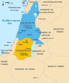 | ۷۲۰ × ۸۵۹ (۷۹ کلوبائٹ) | Malus Catulus | Fixed Judah color | |
| ۱۵:۵۱, ۱۳ جولائی ۲۰۱۰ |  | ۷۲۰ × ۸۵۹ (۷۹ کلوبائٹ) | Malus Catulus | Added colors for the two kingdoms and converted their text to path and arial | |
| ۰۴:۵۳, ۱۳ جولائی ۲۰۱۰ |  | ۷۲۰ × ۸۵۹ (۶۲ کلوبائٹ) | Malus Catulus | Shrinked down the borders | |
| ۰۰:۴۳, ۱۳ جولائی ۲۰۱۰ |  | ۷۲۰ × ۸۵۹ (۶۲ کلوبائٹ) | Malus Catulus | {{Information |Description={{en|1=Map showing the ancient levant borders and ancient cities such as Urmomium and Jerash. The map also shows the region in the 9th century BCE. Notice the coastal land of Philistia, from which the name "Palestine |
فائل دی ورتوں
تھلے دتے گئے 5 صفحے اس فائل نال جُڑدے نیں
فائل ویاپک ورتوں
ایہہ دوجے وکیاں ایس فائل نوں ورتدے نیں –
- af.wikipedia.org تے ورتوں
- als.wikipedia.org تے ورتوں
- arz.wikipedia.org تے ورتوں
- azb.wikipedia.org تے ورتوں
- az.wikipedia.org تے ورتوں
- be-tarask.wikipedia.org تے ورتوں
- be.wikipedia.org تے ورتوں
- bg.wikipedia.org تے ورتوں
- bn.wikipedia.org تے ورتوں
- br.wikipedia.org تے ورتوں
- bs.wikipedia.org تے ورتوں
- bxr.wikipedia.org تے ورتوں
- ca.wikipedia.org تے ورتوں
- cdo.wikipedia.org تے ورتوں
- cs.wikipedia.org تے ورتوں
- da.wikipedia.org تے ورتوں
- de.wikipedia.org تے ورتوں
- de.wikibooks.org تے ورتوں
- en.wikipedia.org تے ورتوں
ایس فائل دا ویکھو ہور جگت ورتن .

