فائل:Irish Sea satellite image.jpg
اس توں وڈی مورت موجود نہیں۔
Irish_Sea_satellite_image.jpg (۴۳۶ × ۵۷۶ پکسلز, فائل حجم: ۵۴ کلوبائٹ, MIME type: image/jpeg)
خلاصہ
| تفصیل |
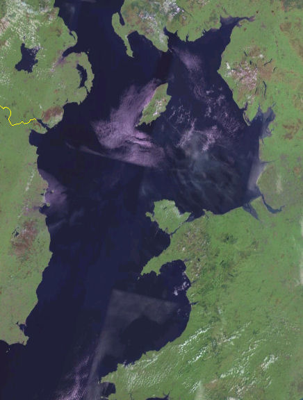
English: Satellite image of the Irish Sea from the NASA Blue Marble project.
Español: Mapa del Mar de Irlanda en el proyecto Blue Marble de la NASA. |
| تریخ | ۱۵ جون ۲۰۱۲, ۱۹:۴۹ (UTC) (upload date) |
| سروت |
This file was derived from: Irish Sea 4.82844W 53.54821N.png: |
| لکھاری |
|
| This is a retouched picture, which means that it has been digitally altered from its original version. Modifications: Cropped. The original can be viewed here: Irish Sea 4.82844W 53.54821N.png:
|
لائسنس –
| This image is in the public domain because it is a screenshot from NASA’s globe software World Wind using a public domain layer, such as Blue Marble, MODIS, Landsat, SRTM, USGS or GLOBE.
|
 |
پہلا اپلوڈ دا ریکارڈ
This image is a derivative work of the following images:
- File:Irish_Sea_4.82844W_53.54821N.png licensed with PD-WorldWind
- 2005-05-20T19:09:05Z Jelte 992x653 (934277 Bytes) NASA [[World-Wind]] screenshot. {{PD-USGov-NASA}}
Uploaded with derivativeFX
فائل دی تریخ
فائل نو اس ویلے دی حالت وچ ویکھن واسطے تاریخ/ویلے تے کلک کرو۔
| تریخ تے ویلہ | نکی مورت | پاسے | ورتن والا | تیپّݨی کرو | |
|---|---|---|---|---|---|
| موجودہ | ۰۰:۵۴, ۱۶ جون ۲۰۱۲ | | ۴۳۶ × ۵۷۶ (۵۴ کلوبائٹ) | Dr Greg | == {{int:filedesc}} == {{Information |Description={{en|Satellite image of the en:Irish Sea from the NASA Blue Marble project.}} {{es|Mapa del es:Mar de Irlanda en el proyecto Blue Marble de la NASA.}} |Source={{Derived from|Irish_Sea_4.8284... |
فائل دی ورتوں
تھلے دتے گئے 1 صفحے اس فائل نال جُڑدے نیں
فائل ویاپک ورتوں
ایہہ دوجے وکیاں ایس فائل نوں ورتدے نیں –
- af.wikipedia.org تے ورتوں
- azb.wikipedia.org تے ورتوں
- bh.wikipedia.org تے ورتوں
- ckb.wikipedia.org تے ورتوں
- de.wikipedia.org تے ورتوں
- el.wikipedia.org تے ورتوں
- en.wikipedia.org تے ورتوں
- fi.wikipedia.org تے ورتوں
- frr.wikipedia.org تے ورتوں
- he.wikipedia.org تے ورتوں
- hu.wikipedia.org تے ورتوں
- kk.wikipedia.org تے ورتوں
- la.wikipedia.org تے ورتوں
- mr.wikipedia.org تے ورتوں
- pl.wikipedia.org تے ورتوں
- rue.wikipedia.org تے ورتوں
- sr.wikipedia.org تے ورتوں
- sv.wikipedia.org تے ورتوں
- th.wikipedia.org تے ورتوں
- uk.wikipedia.org تے ورتوں
- vi.wikipedia.org تے ورتوں