فائل:Hvo controlled.png
اصل فائل (۱,۲۲۰ × ۱,۱۰۰ پکسلز, فائل حجم: ۹۹ کلوبائٹ, MIME type: image/png)
خلاصہ
(
| تفصیل |
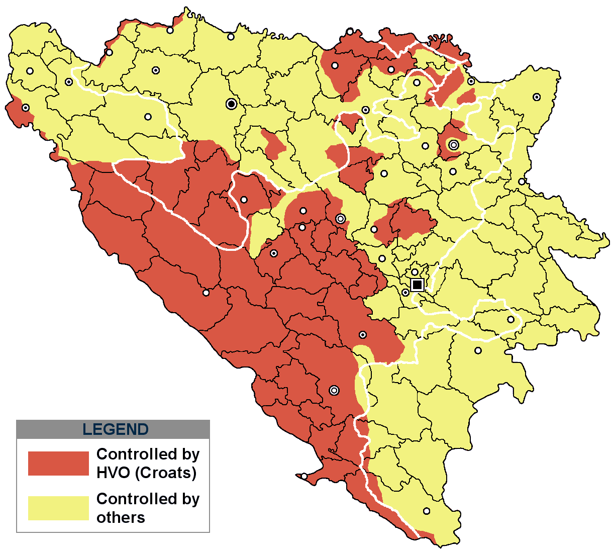
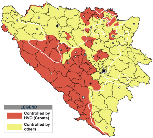
This is an update for the previous map, as the HVO never controlled all parts of municipality of Mostar and Stolac. Also, HVO never controlled neither part of municipalities Nevesinje, Berkovići, Ljubinje and Trebinje.
|
| تریخ | |
| سروت | self-made by Nihad Hamzić |
| لکھاری | Nihad Hamzic |
}
لائسنس –
| اس کم نوں لوکاں لئی ایدے لکھاریI, Nihad Hamzic نے دے دتا اے، اے سارے جگ واسطے لاگو اے۔ کج ملکاں چ قانونی طور تے اے ممکن نئیں اے؛ اگر انج ای اے ے: I, Nihad Hamzic ہر کسے نوں اس کم نوں کسے وی مقصد واسطے ورتن دا بغیر کسے شرط دے حق دیندا واں، اگر اوہ قانون دے خلاف نا ہوۓ۔ |
The original image is here:
http://commons.wikimedia.org/wiki/Image:Hvo_controled.GIF
Check its description for licensing etc.
فائل دی تریخ
فائل نو اس ویلے دی حالت وچ ویکھن واسطے تاریخ/ویلے تے کلک کرو۔
| تریخ تے ویلہ | نکی مورت | پاسے | ورتن والا | تیپّݨی کرو | |
|---|---|---|---|---|---|
| موجودہ | ۲۲:۲۱, ۲۹ نومبر ۲۰۲۰ | | ۱,۲۲۰ × ۱,۱۰۰ (۹۹ کلوبائٹ) | Ceha | Tuzla i Bugojno |
| ۱۸:۳۱, ۲۸ نومبر ۲۰۲۰ |  | ۱,۲۲۰ × ۱,۱۰۰ (۹۸ کلوبائٹ) | Ceha | Dodao neke promjene, od Ravne-Brčko, do Ravnog na jugu (operacija Bura https://hr.wikipedia.org/wiki/Operacija_Bura ) | |
| ۲۲:۴۰, ۲۰ جولائی ۲۰۱۱ |  | ۱,۲۲۰ × ۱,۱۰۰ (۴۸ کلوبائٹ) | DIREKTOR | Colors | |
| ۱۴:۲۹, ۱۱ فروری ۲۰۰۹ |  | ۱,۲۲۰ × ۱,۱۰۰ (۴۹ کلوبائٹ) | Ceha | Corrected errors in Komušina municipality, HVO controled all of Croatian settlments till 10th of August 1991 | |
| ۱۳:۲۴, ۱۱ اگست ۲۰۰۸ |  | ۱,۲۲۰ × ۱,۱۰۰ (۴۹ کلوبائٹ) | Mostarac | {{Information |Description=This is an update for the previous map, as the HVO never controlled all parts of municipality of Mostar and Stolac. Also, HVO never controlled neither part of municipalities Nevesinje, Berkovići and Ljubinje. |Source=self-made | |
| ۱۹:۳۳, ۵ جنوری ۲۰۰۸ |  | ۱,۲۲۰ × ۱,۱۰۰ (۴۹ کلوبائٹ) | Nihad Hamzic | Added a legend. Also widened the image slightly to match the size of related images. I did not resize it, but added white space at sides. | |
| ۱۵:۰۸, ۱۷ جولائی ۲۰۰۷ |  | ۱,۲۱۳ × ۱,۱۰۰ (۴۱ کلوبائٹ) | Nihad Hamzic | Revised the colors to match (to be uniform) with colors in other related maps. | |
| ۰۳:۳۱, ۱۶ جولائی ۲۰۰۷ |  | ۱,۲۱۳ × ۱,۱۰۰ (۴۱ کلوبائٹ) | Nihad Hamzic | {{Information |Description=BiH territories which were controlled by HVO and regular Croatian Army for some time during the war. <br /> <br /> NOTICE:<br /> This image is a greatly optimised PNG version of the original GIF version of the image. Color dihte |
فائل دی ورتوں
تھلے دتے گئے 1 صفحے اس فائل نال جُڑدے نیں
فائل ویاپک ورتوں
ایہہ دوجے وکیاں ایس فائل نوں ورتدے نیں –
- ar.wikipedia.org تے ورتوں
- ast.wikipedia.org تے ورتوں
- bs.wikipedia.org تے ورتوں
- ca.wikipedia.org تے ورتوں
- cs.wikipedia.org تے ورتوں
- de.wikipedia.org تے ورتوں
- es.wikipedia.org تے ورتوں
- eu.wikipedia.org تے ورتوں
- fr.wikipedia.org تے ورتوں
- gl.wikipedia.org تے ورتوں
- hy.wikipedia.org تے ورتوں
- hyw.wikipedia.org تے ورتوں
- it.wikipedia.org تے ورتوں
- pt.wikipedia.org تے ورتوں
- ru.wikipedia.org تے ورتوں
- sr.wikipedia.org تے ورتوں
- sv.wikipedia.org تے ورتوں
- vi.wikipedia.org تے ورتوں