فائل:Blank-Map-Iran-With-Water-Bodies.PNG

ایس وکھالے دا ناپ: ۶۵۲ × ۶۰۰ پکسلز۔ دوجے ریزولوشنز: ۲۶۱ × ۲۴۰ پکسلز | ۵۲۲ × ۴۸۰ پکسلز | ۸۹۵ × ۸۲۳ پکسلز ۔
اصل فائل (۸۹۵ × ۸۲۳ پکسلز, فائل حجم: ۲۸ کلوبائٹ, MIME type: image/png)
خلاصہ
| تفصیل |
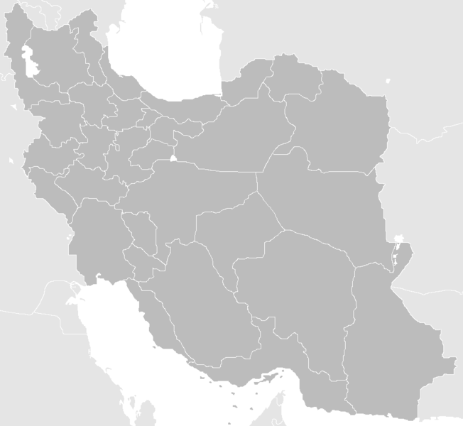
English: Blank Map of the territory claimed by Iran With Water Bodies and Neighbors فارسی: نقشه خالی ایران به همراه سرزمینهای آبی و کشورهای همسایه |
| تریخ | |
| سروت | self-made adding water bodies and neighbors and applying some corrections and updates to a previous version Image:Blank-Map-Iran.PNG, which in turn was a corrected and updated version of Image:BlankMap-Iran.PNG created and uploaded by Shinas |
| لکھاری | Siamax |
لائسنس –
| اس کم نوں لوکاں لئی ایدے لکھاریI, Siamax نے دے دتا اے، اے سارے جگ واسطے لاگو اے۔ کج ملکاں چ قانونی طور تے اے ممکن نئیں اے؛ اگر انج ای اے ے: I, Siamax ہر کسے نوں اس کم نوں کسے وی مقصد واسطے ورتن دا بغیر کسے شرط دے حق دیندا واں، اگر اوہ قانون دے خلاف نا ہوۓ۔ |
فائل دی تریخ
فائل نو اس ویلے دی حالت وچ ویکھن واسطے تاریخ/ویلے تے کلک کرو۔
| تریخ تے ویلہ | نکی مورت | پاسے | ورتن والا | تیپّݨی کرو | |
|---|---|---|---|---|---|
| موجودہ | ۱۶:۳۳, ۲۳ جون ۲۰۱۳ | | ۸۹۵ × ۸۲۳ (۲۸ کلوبائٹ) | BasilLeaf | بروزرسانی استانهای یزد و خراسان جنوبی |
| ۱۷:۳۲, ۱۲ نومبر ۲۰۱۰ |  | ۸۹۵ × ۸۲۳ (۴۳ کلوبائٹ) | M samadi | Border of South & Razavi Khorasans updated. | |
| ۱۰:۰۷, ۱۸ اکتوبر ۲۰۱۰ |  | ۸۹۵ × ۸۲۳ (۴۶ کلوبائٹ) | Siamax | Alborz province added | |
| ۰۳:۰۱, ۳۰ جولائی ۲۰۰۷ |  | ۸۹۵ × ۸۲۳ (۴۶ کلوبائٹ) | Siamax | == Summary == {{Information |Description=Blank Map of Iran With Water Bodies and Neighbors |Source=self-made adding water bodies and neighbors and applying some corrections and updates to a previous version Image:Blank-Map-Iran.PNG, which in turn wa | |
| ۲۳:۳۹, ۲۹ جولائی ۲۰۰۷ |  | ۸۹۵ × ۸۲۳ (۴۶ کلوبائٹ) | Siamax | {{Information |Description=Blank Map of Iran With Water Bodies and Neighbors |Source=self-made adding water bodies and neighbors and applying some corrections and updates to a previous version Image:Blank-Map-Iran.PNG, which in turn was a corrected |
فائل دی ورتوں
تھلے دتے گئے 30 صفحے اس فائل نال جُڑدے نیں
- ایرانشہر
- خاش
- دلگان
- زابل،ایران
- زابلی
- زہک
- سب و سوران
- سراوان
- سرباز (شہر)
- شہرستان ایرانشہر
- شہرستان خاش
- شہرستان دلگان
- شہرستان زابل
- شہرستان زابلی
- شہرستان زاہدان
- شہرستان زہک
- شہرستان سب و سوران
- شہرستان سراوان
- شہرستان سرباز
- شہرستان نیک شہر
- شہرستان چاہ بہار
- شہرستان کنارک
- شہرستان ہرمند
- صوبہ سیستان و بلوچستان
- نیک شہر
- چابہار
- کنارک
- ہرمند
- سانچہ:صوبہ سیستان و بلوچستان دے شہر
- سانچہ:صوبہ سیستان و بلوچستان دے شہرستان
فائل ویاپک ورتوں
ایہہ دوجے وکیاں ایس فائل نوں ورتدے نیں –
- ar.wikipedia.org تے ورتوں
- av.wikipedia.org تے ورتوں
- ba.wikipedia.org تے ورتوں
- bn.wikipedia.org تے ورتوں
- ce.wikipedia.org تے ورتوں
- ckb.wikipedia.org تے ورتوں
- diq.wikipedia.org تے ورتوں
- el.wikipedia.org تے ورتوں
- en.wikipedia.org تے ورتوں
- Law Enforcement Command of the Islamic Republic of Iran
- User:Siamax
- Template:Provinces of Iran Labelled Map
- User:Jonny-mt/Gallery of current first-level administrative country subdivisions maps
- Outline of Iran
- Administrative divisions of Iran
- Talk:Iran/Archive 11
- List of cities in Iran by province
- User:Reza1615/pdf2
- Borders of Iran
- User:Falcaorib
- eu.wikipedia.org تے ورتوں
- fa.wikipedia.org تے ورتوں
- fi.wikipedia.org تے ورتوں
- hi.wikipedia.org تے ورتوں
- hr.wikipedia.org تے ورتوں
- hu.wiktionary.org تے ورتوں
- id.wikipedia.org تے ورتوں
- is.wikipedia.org تے ورتوں
- kk.wikipedia.org تے ورتوں
ایس فائل دا ویکھو ہور جگت ورتن .