فائل:Afghanistan-Nimruz.png
اس توں وڈی مورت موجود نہیں۔
Afghanistan-Nimruz.png (۳۰۰ × ۲۳۰ پکسلز, فائل حجم: ۹ کلوبائٹ, MIME type: image/png)
خلاصہ
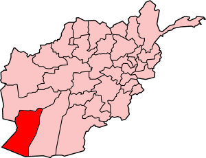
Map of Afghanistan showing Nimruz province. Made by User:Golbez, based on original map by Morwen on en.wikipedia.
لائسنس –

|
کاپی کرن، ونڈن تے بدلن دی ایس ڈوکومنٹ لئی اجازت دتی جاندی اے ایہناں GNU Free Documentation License, Version 1.2 شرطاں نال یا مگروں کسے وی چھپے ورین Free Software Foundation توں بنا کسے انویرینٹ سیکشن دے، ناں فرنٹ کور لکھت تے ناں بیک کور لکھت دے۔ لسنس دی اک کاپی سیکشن وچ ہیگی اے جہدا ناں اے GNU Free Documentation License۔ |
| ایس فائل نوں کریٹو کامنز Attribution 2.5 پولینڈ لائسنس دتا گیا. | ||
| ||
| اس لائسنس دا ٹیگ GFDL دے مطابق اس فائل چ پایا گیا اے licensing update۔ |
فائل دی تریخ
فائل نو اس ویلے دی حالت وچ ویکھن واسطے تاریخ/ویلے تے کلک کرو۔
| تریخ تے ویلہ | نکی مورت | پاسے | ورتن والا | تیپّݨی کرو | |
|---|---|---|---|---|---|
| موجودہ | ۰۹:۵۴, ۲۹ ستمبر ۲۰۰۵ | | ۳۰۰ × ۲۳۰ (۹ کلوبائٹ) | Golbez | Map of Afghanistan showing Nimruz province. Made by User:Golbez, based on original map by Morwen on en.wikipedia. ==Licensing== {{self|cc-by-2.5}} |
فائل دی ورتوں
تھلے دتے گئے 1 صفحے اس فائل نال جُڑدے نیں
فائل ویاپک ورتوں
ایہہ دوجے وکیاں ایس فائل نوں ورتدے نیں –
- ar.wikipedia.org تے ورتوں
- be.wikipedia.org تے ورتوں
- bn.wikipedia.org تے ورتوں
- cy.wikipedia.org تے ورتوں
- en.wikipedia.org تے ورتوں
- Chakhansur District
- Chahar Burjak District
- Kang District
- Khash Rod District
- Dasht-e Margo
- Template:Nimruz-geo-stub
- Delaram
- Zaranj District
- Chakhansur (village)
- Istoway
- 2011 Nimruz province bombing
- Dasht-e Khash
- Delaram District
- Ghorghori
- Khash, Nimruz
- Lukhi, Khash Rod
- Khunia
- Shishawa
- Mazad village
- Razi Balochi
- Dasht-e Shesh Ābeh
- fa.wikipedia.org تے ورتوں
- hi.wikipedia.org تے ورتوں
- incubator.wikimedia.org تے ورتوں
- ko.wikipedia.org تے ورتوں
- mzn.wikipedia.org تے ورتوں
- ps.wikipedia.org تے ورتوں
- pt.wikipedia.org تے ورتوں
- sco.wikipedia.org تے ورتوں
- su.wikipedia.org تے ورتوں
- tg.wikipedia.org تے ورتوں
- tr.wikipedia.org تے ورتوں
ایس فائل دا ویکھو ہور جگت ورتن .