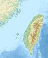
فائل:Taiwan relief location map.jpg

ایس وکھالے دا ناپ: ۴۹۸ × ۵۹۹ پکسلز۔ دوجے ریزولوشنز: ۱۹۹ × ۲۴۰ پکسلز | ۳۹۹ × ۴۸۰ پکسلز | ۱,۰۱۶ × ۱,۲۲۲ پکسلز ۔
اصل فائل (۱,۰۱۶ × ۱,۲۲۲ پکسلز, فائل حجم: ۱۰۱ کلوبائٹ, MIME type: image/jpeg)
فائل دی تریخ
فائل نو اس ویلے دی حالت وچ ویکھن واسطے تاریخ/ویلے تے کلک کرو۔
| تریخ تے ویلہ | نکی مورت | پاسے | ورتن والا | تیپّݨی کرو | |
|---|---|---|---|---|---|
| موجودہ | ۱۹:۰۱, ۱۹ ستمبر ۲۰۱۹ |  | ۱,۰۱۶ × ۱,۲۲۲ (۱۰۱ کلوبائٹ) | Geographyinitiative | temporary fix: extending the boundary out around Dongyin Township (as in China Fujian2 location map.svg and as in File:Nationalist China - administrative divisons. LOC 2007633622.jpg) |
| ۲۲:۰۹, ۳ اگست ۲۰۱۹ |  | ۱,۰۱۶ × ۱,۲۲۲ (۵۳۷ کلوبائٹ) | NordNordWest | border corrections | |
| ۰۶:۵۱, ۳ اگست ۲۰۱۹ |  | ۱,۰۱۶ × ۱,۲۲۲ (۹۶ کلوبائٹ) | Geographyinitiative | Proposed removal of three dashes (markers of the approximate PRC/ROC maritime boundary) which seemed to put Dadan Island, Erdan Island and Binlang Islet (檳榔嶼) outside the territory of Kinmen County, Taiwan/ROC. This is not the optimal form of the map, but is merely a quick removal of incorrect information. In the optimal situation, the line needs to be redrawn in the correct location, but I don't have the technical skill to produce such a map. (Basis: [http://ws.mac.gov.tw/001/Upload/OldFile/... | |
| ۰۵:۳۰, ۳ اگست ۲۰۱۹ |  | ۱,۰۱۶ × ۱,۲۲۲ (۹۶ کلوبائٹ) | Geographyinitiative | Proposed removal of two dashes (markers of the approximate PRC/ROC maritime boundary) which seemed to put {{w|Dadan Island}} and {{w|Erdan Island}} outside the territory of {{w|Kinmen County}}, Taiwan/ROC. | |
| ۲۲:۲۲, ۲۸ دسمبر ۲۰۱۰ |  | ۱,۰۱۶ × ۱,۲۲۲ (۴۵۲ کلوبائٹ) | Uwe Dedering | {{Information |Description={{en|1=Relief location map of Taiwan. * Projection: Equirectangular projection, strechted by 110.0%. * Geographic limits of the map: :* N: 26.4° N :* S: 21.7° N :* W: 118.0° E :* E: 122.3° E * GMT projection: -JX17.204266666 |
فائل دی ورتوں
تھلے دتے گئے 1 صفحے اس فائل نال جُڑدے نیں
فائل ویاپک ورتوں
ایہہ دوجے وکیاں ایس فائل نوں ورتدے نیں –
- ar.wikipedia.org تے ورتوں
- ast.wikipedia.org تے ورتوں
- az.wikipedia.org تے ورتوں
- ba.wikipedia.org تے ورتوں
- bcl.wikipedia.org تے ورتوں
- be.wikipedia.org تے ورتوں
- bn.wikipedia.org تے ورتوں
- bs.wikipedia.org تے ورتوں
- ceb.wikipedia.org تے ورتوں
- ce.wikipedia.org تے ورتوں
- ckb.wikipedia.org تے ورتوں
- de.wikipedia.org تے ورتوں
- de.wikivoyage.org تے ورتوں
ایس فائل دا ویکھو ہور جگت ورتن .
