فائل:ProspectPark Brooklyn Nethermead.jpg
اصل فائل (۱,۷۷۷ × ۷۰۲ پکسلز, فائل حجم: ۵۵۸ کلوبائٹ, MIME type: image/jpeg)
خلاصہ
| Camera location | | View this and other nearby images on: OpenStreetMap |
|---|
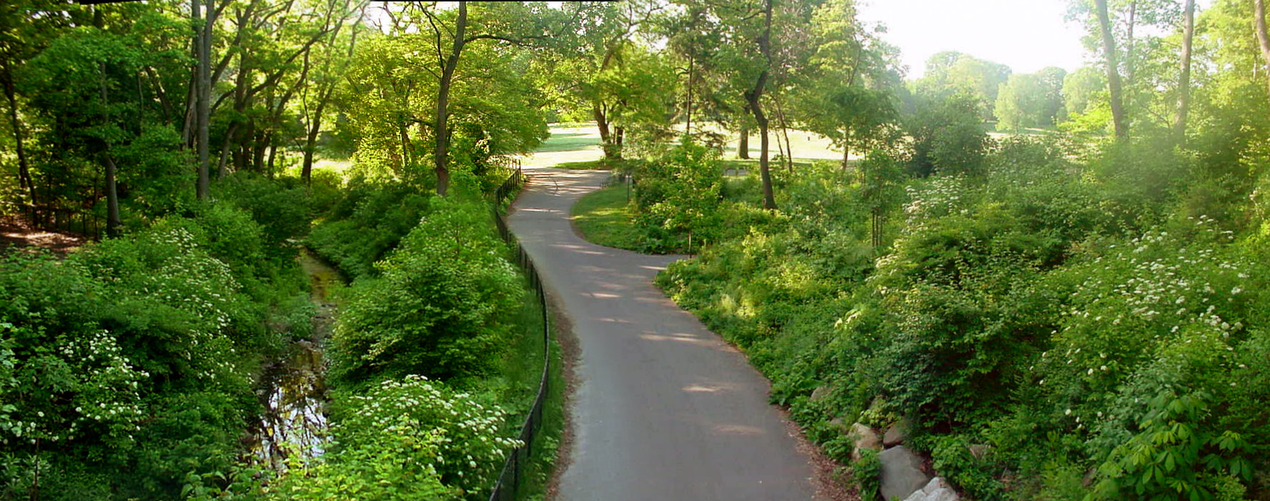
| تفصیل | Nethermead, Prospect Park, Brooklyn |
| تریخ | |
| سروت | Author's own work; a composite of digital images composing a panorama |
| لکھاری | Garry R. Osgood |
| اجازت (فائل نوں دوبارہ ورتنا) |
Available under Creative Commons License and GFDL |
Looking south from the transverse roadway running over Nethermead Arches Bridge in Prospect Park, Brooklyn City of New York. June 05, 2005. about 7:00 AM EDT. The Nethermead is in the background center and toward the right. The footpath running from foreground to background runs under the western-most of the three arches that make up the bridge. The stream that runs through the Ravine flows under the middle arch; this stream is left of center in the photograph. A horse trail runs under the eastern-most arch and is barely visible off to the left. Nethermead Arches Bridge is situated approximately in the geographic center of the park and is an original structure of the park. (1869-1870). Following the path a ways further brings one to the Music Pagoda (1887), hidden in the middle ground trees off to the left. Even further, the footpath branches again; the right hand fork leads to the Lullwater Bridge and the left hand fork leads to the Binnen Bridge, overlooking the Binnen Falls. See the Prospect Park Alliance Map[dead link] for more information on park features.
This is a composite of four digital images, each produced by a Sony Mavica, FD-90.
لائسنس –

|
کاپی کرن، ونڈن تے بدلن دی ایس ڈوکومنٹ لئی اجازت دتی جاندی اے ایہناں GNU Free Documentation License, Version 1.2 شرطاں نال یا مگروں کسے وی چھپے ورین Free Software Foundation توں بنا کسے انویرینٹ سیکشن دے، ناں فرنٹ کور لکھت تے ناں بیک کور لکھت دے۔ لسنس دی اک کاپی سیکشن وچ ہیگی اے جہدا ناں اے GNU Free Documentation License۔ |
| ایس فائل نوں کریٹو کامنز Attribution 2.5 پولینڈ لائسنس دتا گیا. | ||
| ||
| اس لائسنس دا ٹیگ GFDL دے مطابق اس فائل چ پایا گیا اے licensing update۔ |
- تہانوں کھلھ اے:
- حصہ کرنا – کاپی، ونڈنا تے کم بھیجنا
- فیر رلانا – کم نوں فٹ کرنا
- تھلے دتیاں شرطاں نال:
- کس دے ناں – تسیں لازمی ایس کم دے بناں والے بارے دسو جنج اونے آکھیا اے یا جنج لسنس چ آکھیا گیا ہے۔
فائل دی تریخ
فائل نو اس ویلے دی حالت وچ ویکھن واسطے تاریخ/ویلے تے کلک کرو۔
| تریخ تے ویلہ | نکی مورت | پاسے | ورتن والا | تیپّݨی کرو | |
|---|---|---|---|---|---|
| موجودہ | ۱۵:۵۹, ۲۳ جولائی ۲۰۰۶ | ۱,۷۷۷ × ۷۰۲ (۵۵۸ کلوبائٹ) | Garry R. Osgood | {{ |Description=Nethermead, Prospect Park, Brooklyn |Source=Author's own work; a composite of digitial images composing a panorama |Date=June 05, 2005 |Author=Garry R. Osgood |Permission=Available under Creative Commons License and GFDL }} Looking south f |
فائل دی ورتوں
تھلے دتے گئے 1 صفحے اس فائل نال جُڑدے نیں
فائل ویاپک ورتوں
ایہہ دوجے وکیاں ایس فائل نوں ورتدے نیں –
- de.wikipedia.org تے ورتوں
- en.wikipedia.org تے ورتوں
- en.wikiversity.org تے ورتوں
- en.wikivoyage.org تے ورتوں
- es.wikipedia.org تے ورتوں
- ga.wikipedia.org تے ورتوں