فائل:Isparta districts.png
ایس وکھالے دا ناپ: ۷۷۶ × ۶۰۰ پکسلز۔ دوجے ریزولوشنز: ۳۱۱ × ۲۴۰ پکسلز | ۶۲۱ × ۴۸۰ پکسلز | ۹۹۴ × ۷۶۸ پکسلز | ۱,۰۵۶ × ۸۱۶ پکسلز ۔
اصل فائل (۱,۰۵۶ × ۸۱۶ پکسلز, فائل حجم: ۴۱ کلوبائٹ, MIME type: image/png)
خلاصہ
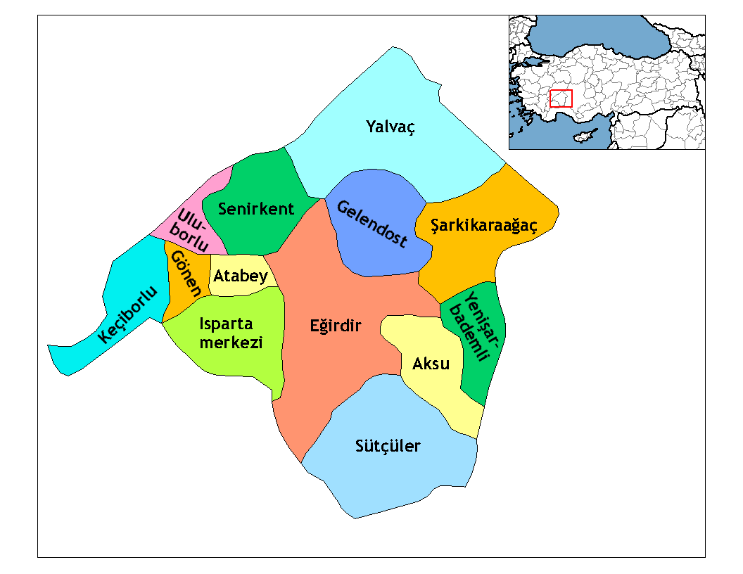
| تفصیل | Map of the districts of Isparta province in Turkey. Created by Rarelibra 20:57, 1 December 2006 (UTC) for public domain use, using MapInfo Professional v8.5 and various mapping resources. Edited by One Homo Sapiens Corrected text where İ,Ş,ı,ğ,or ş occurs in name. Source: [statoids-com]. Increased font size and enhanced color differences among adjacent districts. |
| تریخ | ۱ دسمبر ۲۰۰۶ (original upload date) |
| سروت | No machine-readable source provided. Own work assumed (based on copyright claims). |
| لکھاری | No machine-readable author provided. Rarelibra assumed (based on copyright claims). |
لائسنس –
| میں، اس کم دے کاپیرائٹ دا مالک، اس کم نوں لوکاں واسطے دیندا واں۔ اے سارے جگ واسطے لاگو اے۔ کج ملکاں چ قانونی طور تے اے ممکن نئیں اے؛ اگر انج ای اے ے: میں ہر کسے نوں اس کم نوں کسے وی مقصد واسطے ورتن دا بغیر کسے شرط دے حق دیندا واں، اگر اوہ قانون دے خلاف نا ہوۓ۔ |
فائل دی تریخ
فائل نو اس ویلے دی حالت وچ ویکھن واسطے تاریخ/ویلے تے کلک کرو۔
| تریخ تے ویلہ | نکی مورت | پاسے | ورتن والا | تیپّݨی کرو | |
|---|---|---|---|---|---|
| موجودہ | ۰۳:۴۲, ۲۹ دسمبر ۲۰۰۸ | | ۱,۰۵۶ × ۸۱۶ (۴۱ کلوبائٹ) | One Homo Sapiens | Corrected text where İ,Ş,ı,ğ,or ş occurs in name. Source: [statoids-com]. Increased font size and enhanced color differences among adjacent districts. |
| ۰۱:۵۷, ۲ دسمبر ۲۰۰۶ |  | ۱,۰۵۶ × ۸۱۶ (۳۱ کلوبائٹ) | Rarelibra | Map of the districts of Isparta province in Turkey. Created by ~~~~ for public domain use, using MapInfo Professional v8.5 and various mapping resources. |
فائل دی ورتوں
تھلے دتے گئے 1 صفحے اس فائل نال جُڑدے نیں
فائل ویاپک ورتوں
ایہہ دوجے وکیاں ایس فائل نوں ورتدے نیں –
- arz.wikipedia.org تے ورتوں
- ast.wikipedia.org تے ورتوں
- ba.wikipedia.org تے ورتوں
- ca.wikipedia.org تے ورتوں
- de.wikipedia.org تے ورتوں
- diq.wikipedia.org تے ورتوں
- en.wikipedia.org تے ورتوں
- Isparta Province
- User talk:Rarelibra/Maps4
- List of populated places in Isparta Province
- Districts of Turkey
- Governor of Isparta
- Senirkent District
- Aksu District, Isparta
- Atabey District
- Eğirdir District
- Gelendost District
- Gönen District, Isparta
- Isparta District
- Keçiborlu District
- Şarkikaraağaç District
- Sütçüler District
- Uluborlu District
- Yalvaç District
- Yenişarbademli District
- eo.wikipedia.org تے ورتوں
- es.wikipedia.org تے ورتوں
- eu.wikipedia.org تے ورتوں
- fa.wikipedia.org تے ورتوں
- fi.wikipedia.org تے ورتوں
- fr.wikipedia.org تے ورتوں
ایس فائل دا ویکھو ہور جگت ورتن .