فائل:China Xinjiang location map.svg

اصل فائل (ایس وی جی فائل، پکسل:۲,۲۲۰ × ۱,۹۳۹، فائل سائز: ۴۶۴ کلوبائٹ)
خلاصہ
| تفصیل |
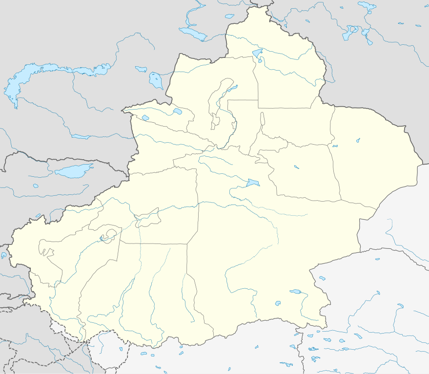
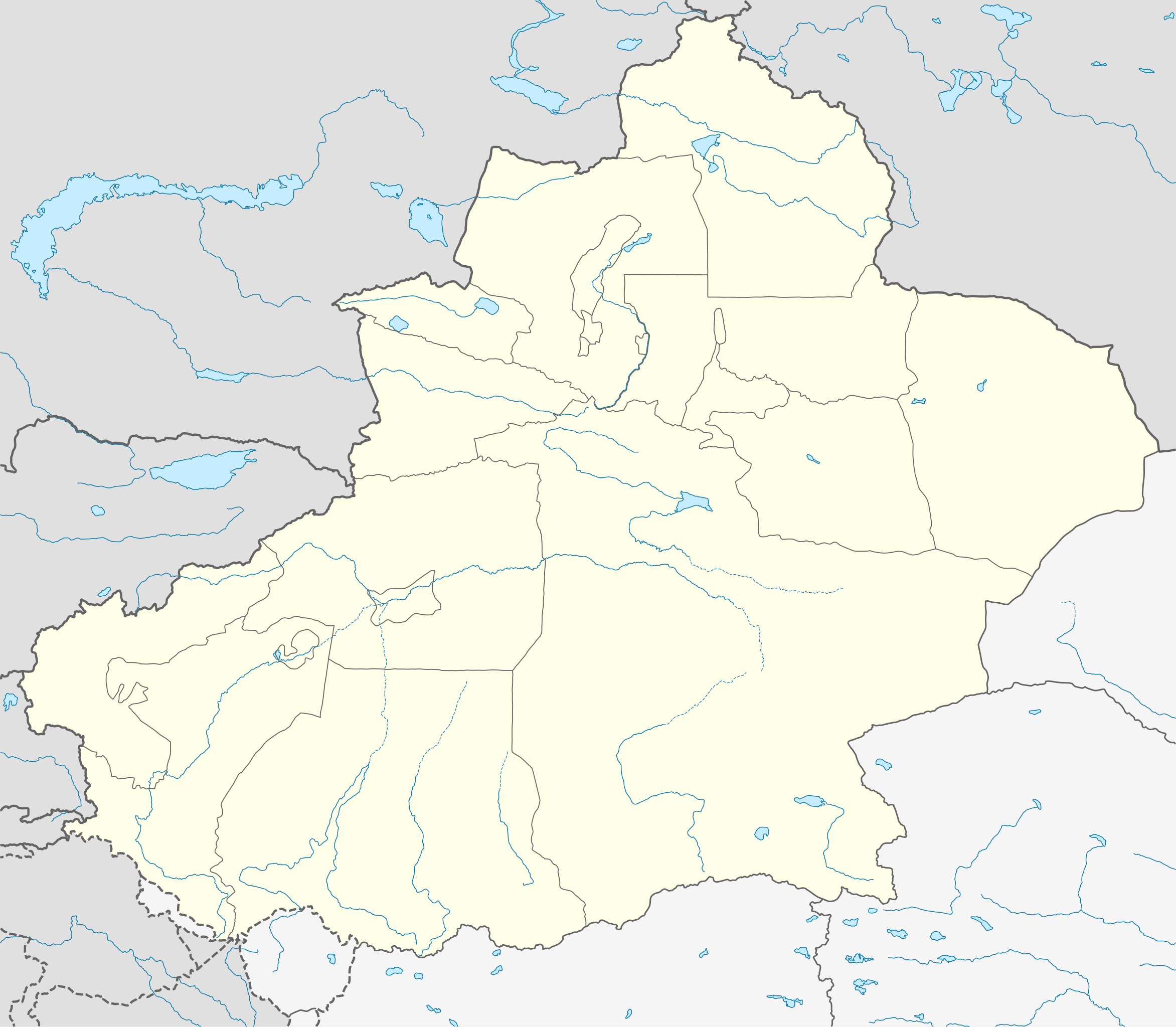
Deutsch: Positionskarte von Xinjiang, Volksrepublik China im Jahr 2010
Quadratische Plattkarte, N-S-Streckung 135 %. Geographische Begrenzung der Karte:
English: Location map of Xinjiang, People's Republic of China, in 2010
Equirectangular projection, N/S stretching 135 %. Geographic limits of the map:
|
||
| تریخ | |||
| سروت |
آپݨا کم, using
|
||
| لکھاری | NordNordWest | ||
| اجازت (فائل نوں دوبارہ ورتنا) |
ایس فائل نوں کریٹو کامنز Attribution 3.0 جرمنی لائسنس دتا گیا.
 ایس فائل نوں کریٹو کامنز Attribution 3.0 جرمنی لائسنس دتا گیا.
|
||
| دوجے ورژن |
|
||
| SVG genesis | This W3C-invalid map was created with Adobe Illustrator.
|


فائل دی تریخ
فائل نو اس ویلے دی حالت وچ ویکھن واسطے تاریخ/ویلے تے کلک کرو۔
| تریخ تے ویلہ | نکی مورت | پاسے | ورتن والا | تیپّݨی کرو | |
|---|---|---|---|---|---|
| موجودہ | ۱۲:۲۳, ۱۰ جون ۲۰۲۰ | | ۲,۲۲۰ × ۱,۹۳۹ (۴۶۴ کلوبائٹ) | NordNordWest | corr |
| ۰۳:۱۶, ۱۰ جون ۲۰۲۰ |  | ۲,۲۲۰ × ۱,۹۳۹ (۴۷۰ کلوبائٹ) | Bjh21 | Reverted to version as of 13:31, 9 June 2020 (UTC): COM:UPLOADWAR; at least two users are of the opinion that this change is not minor, and I'm coming close to that view myself | |
| ۰۳:۰۹, ۱۰ جون ۲۰۲۰ |  | ۲,۲۲۰ × ۱,۹۳۹ (۸۲۰ کلوبائٹ) | Geographyinitiative | Reverted to version as of 01:15, 9 June 2020 (UTC) Incorrect map is incorrect | |
| ۱۸:۳۱, ۹ جون ۲۰۲۰ |  | ۲,۲۲۰ × ۱,۹۳۹ (۴۷۰ کلوبائٹ) | NordNordWest | Reverted to version as of 15:35, 28 December 2012 (UTC) again: only vector data in this svg please | |
| ۰۶:۱۵, ۹ جون ۲۰۲۰ |  | ۲,۲۲۰ × ۱,۹۳۹ (۸۲۰ کلوبائٹ) | Geographyinitiative | Reverted to version as of 05:18, 13 April 2020 (UTC) | |
| ۰۱:۴۸, ۲۵ مئی ۲۰۲۰ |  | ۲,۲۲۰ × ۱,۹۳۹ (۴۷۰ کلوبائٹ) | Roy17 | Reverted to version as of 15:35, 28 December 2012 (UTC) | |
| ۱۰:۱۸, ۱۳ اپریل ۲۰۲۰ |  | ۲,۲۲۰ × ۱,۹۳۹ (۸۲۰ کلوبائٹ) | Geographyinitiative | Reverted to version as of 06:36, 29 January 2019 (UTC) See talk page | |
| ۱۵:۴۱, ۲۹ جنوری ۲۰۱۹ |  | ۲,۲۲۰ × ۱,۹۳۹ (۴۷۰ کلوبائٹ) | NordNordWest | Reverted to version as of 15:35, 28 December 2012 (UTC); only vector data in this svg please | |
| ۱۱:۳۶, ۲۹ جنوری ۲۰۱۹ |  | ۲,۲۲۰ × ۱,۹۳۹ (۸۲۰ کلوبائٹ) | 复旦大学张超 | edit | |
| ۲۰:۳۵, ۲۸ دسمبر ۲۰۱۲ |  | ۲,۲۲۰ × ۱,۹۳۹ (۴۷۰ کلوبائٹ) | NordNordWest | upd |
فائل دی ورتوں
تھلے دتے گئے 1 صفحے اس فائل نال جُڑدے نیں
فائل ویاپک ورتوں
ایہہ دوجے وکیاں ایس فائل نوں ورتدے نیں –
- ar.wikipedia.org تے ورتوں
- ba.wikipedia.org تے ورتوں
- bg.wikipedia.org تے ورتوں
- ceb.wikipedia.org تے ورتوں
- ce.wikipedia.org تے ورتوں
- ckb.wikipedia.org تے ورتوں
- cs.wikipedia.org تے ورتوں
- en.wikipedia.org تے ورتوں
- eo.wikipedia.org تے ورتوں
- es.wikipedia.org تے ورتوں
- et.wikipedia.org تے ورتوں
- fa.wikipedia.org تے ورتوں
- incubator.wikimedia.org تے ورتوں
- kbd.wikipedia.org تے ورتوں
- kn.wikipedia.org تے ورتوں
- ko.wikipedia.org تے ورتوں
- mk.wikipedia.org تے ورتوں
- or.wikipedia.org تے ورتوں
- pl.wikibooks.org تے ورتوں
- ps.wikipedia.org تے ورتوں
- simple.wikipedia.org تے ورتوں
- su.wikipedia.org تے ورتوں
- tr.wikipedia.org تے ورتوں
- vi.wikipedia.org تے ورتوں
- war.wikipedia.org تے ورتوں
- xmf.wikipedia.org تے ورتوں