فائل:BeringBridge.jpg
اس توں وڈی مورت موجود نہیں۔
BeringBridge.jpg (۷۰۰ × ۴۵۴ پکسلز, فائل حجم: ۷۸ کلوبائٹ, MIME type: image/jpeg)
| تفصیل |
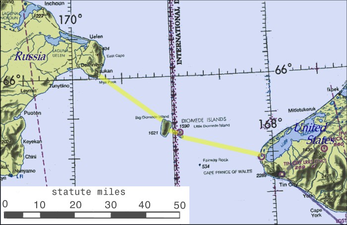
English: Possible routing of International Peace Bridge |
||||||
| سروت | Source of basemap: World Aeronautical Chart CC-8, Federal Aviation Administration | ||||||
| لکھاری | Cleaned up and annotated by contributor. | ||||||
| اجازت (فائل نوں دوبارہ ورتنا) |
|
||||||


|
This map image could be re-created using vector graphics as an SVG file. This has several advantages; see Commons:Media for cleanup for more information. If an SVG form of this image is available, please upload it and afterwards replace this template with
{{vector version available|new image name}}.
It is recommended to name the SVG file “BeringBridge.svg”—then the template Vector version available (or Vva) does not need the new image name parameter. |


فائل دی تریخ
فائل نو اس ویلے دی حالت وچ ویکھن واسطے تاریخ/ویلے تے کلک کرو۔
| تریخ تے ویلہ | نکی مورت | پاسے | ورتن والا | تیپّݨی کرو | |
|---|---|---|---|---|---|
| موجودہ | ۲۱:۵۲, ۷ جنوری ۲۰۰۷ | | ۷۰۰ × ۴۵۴ (۷۸ کلوبائٹ) | Toyota prius 2~commonswiki | == Summary == Possible routing of International Peace Bridge. Source of basemap: World Aeronautical Chart CC-8, Federal Aviation Administration. Cleaned up and annotatated by contributor. == Licensing == {{PD-USGov}} |
فائل دی ورتوں
تھلے دتے گئے 1 صفحے اس فائل نال جُڑدے نیں
فائل ویاپک ورتوں
ایہہ دوجے وکیاں ایس فائل نوں ورتدے نیں –
- bg.wikipedia.org تے ورتوں
- ca.wikipedia.org تے ورتوں
- en.wikipedia.org تے ورتوں
- eo.wikipedia.org تے ورتوں
- es.wikipedia.org تے ورتوں
- fa.wikipedia.org تے ورتوں
- fr.wikipedia.org تے ورتوں
- he.wikipedia.org تے ورتوں
- hu.wikipedia.org تے ورتوں
- id.wikipedia.org تے ورتوں
- it.wikipedia.org تے ورتوں
- nl.wikipedia.org تے ورتوں
- pl.wikipedia.org تے ورتوں
- pt.wikipedia.org تے ورتوں
- ru.wikipedia.org تے ورتوں
- sl.wikipedia.org تے ورتوں
- sq.wikipedia.org تے ورتوں
- sv.wikipedia.org تے ورتوں
- tr.wikipedia.org تے ورتوں
- uk.wikipedia.org تے ورتوں
- ur.wikipedia.org تے ورتوں
- www.wikidata.org تے ورتوں
- zh.wikipedia.org تے ورتوں