فائل:Antikes Alexandria Karte.JPG
ایس وکھالے دا ناپ: ۷۷۳ × ۶۰۰ پکسلز۔ دوجے ریزولوشنز: ۳۱۰ × ۲۴۰ پکسلز | ۶۱۹ × ۴۸۰ پکسلز | ۹۹۰ × ۷۶۸ پکسلز | ۱,۲۸۰ × ۹۹۳ پکسلز | ۱,۶۹۴ × ۱,۳۱۴ پکسلز ۔
اصل فائل (۱,۶۹۴ × ۱,۳۱۴ پکسلز, فائل حجم: ۶۱۱ کلوبائٹ, MIME type: image/jpeg)
| تفصیل |
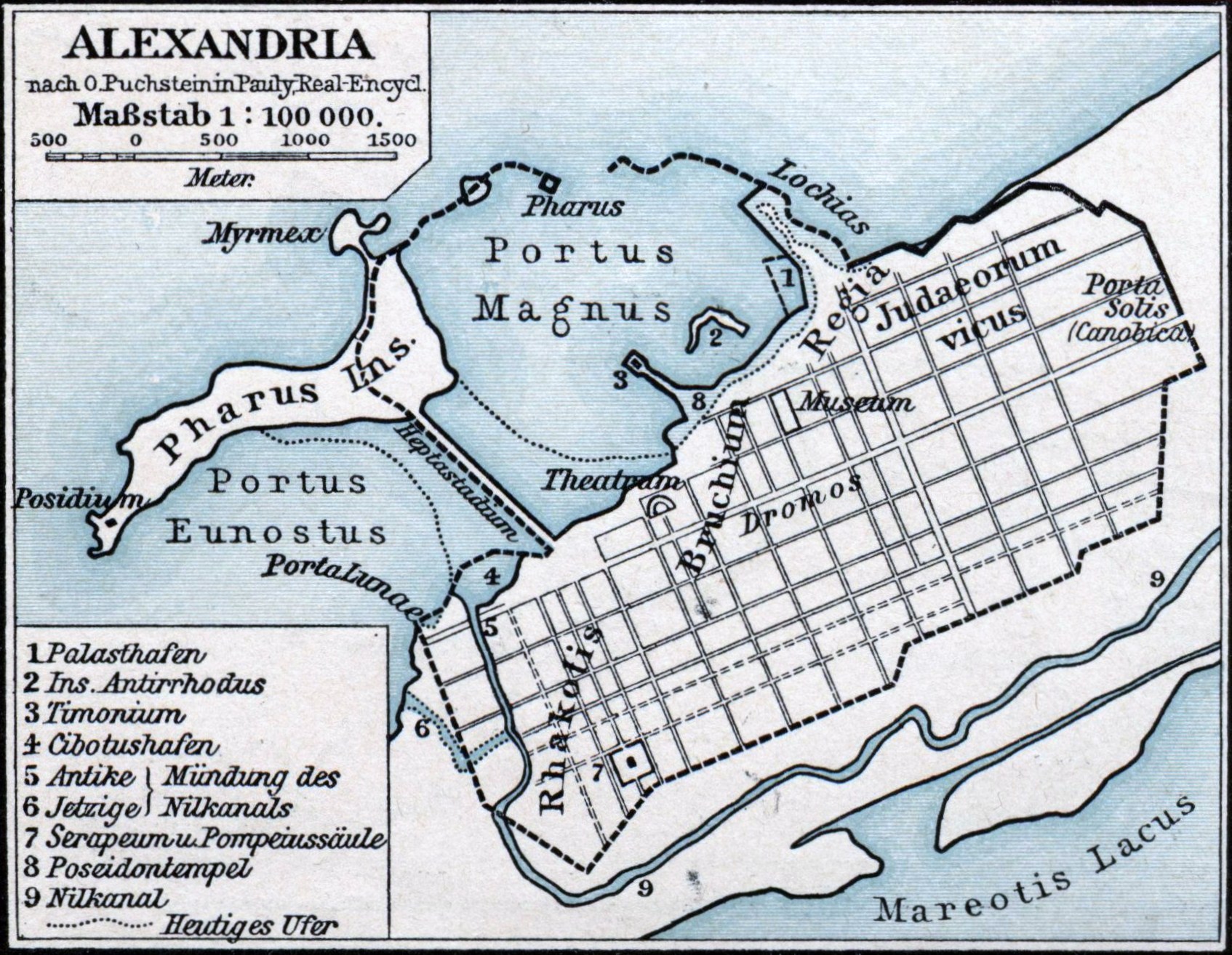
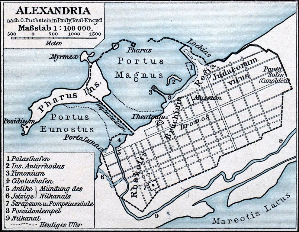
Deutsch: Karte der antiken ägyptischen Stadt Alexandria. |
||||
| تریخ | |||||
| سروت | F. W. Putzgers Historischer Schul-Atlas | ||||
| لکھاری | Friedrich Wilhelm Putzger (1849-1913), nach O. Puchstein in Pauly, Real-Encycl. | ||||
| اجازت (فائل نوں دوبارہ ورتنا) |
|
||||
فائل دی تریخ
فائل نو اس ویلے دی حالت وچ ویکھن واسطے تاریخ/ویلے تے کلک کرو۔
| تریخ تے ویلہ | نکی مورت | پاسے | ورتن والا | تیپّݨی کرو | |
|---|---|---|---|---|---|
| موجودہ | ۰۵:۲۳, ۲۴ جنوری ۲۰۱۱ | | ۱,۶۹۴ × ۱,۳۱۴ (۶۱۱ کلوبائٹ) | Oltau | Farbkorrektur |
| ۰۵:۲۱, ۲۴ جنوری ۲۰۱۱ |  | ۱,۶۹۴ × ۱,۳۱۴ (۶۱۰ کلوبائٹ) | Oltau | {{Information |Description={{de|1=Karte der antiken ägyptischen Stadt Alexandria.}} |Source=F. W. Putzgers Historischer Schul-Atlas |Author=Friedrich Wilhelm Putzger |Date=1901 |Permission={{PD-old}} |other_versions= }} Category:Maps of Alexandria |
فائل دی ورتوں
تھلے دتے گئے 1 صفحے اس فائل نال جُڑدے نیں
فائل ویاپک ورتوں
ایہہ دوجے وکیاں ایس فائل نوں ورتدے نیں –
- ar.wikipedia.org تے ورتوں
- arz.wikipedia.org تے ورتوں
- ast.wikipedia.org تے ورتوں
- bg.wikipedia.org تے ورتوں
- bs.wikipedia.org تے ورتوں
- ca.wikipedia.org تے ورتوں
- de.wikipedia.org تے ورتوں
- en.wikipedia.org تے ورتوں
- en.wikibooks.org تے ورتوں
- es.wikipedia.org تے ورتوں
- fa.wikipedia.org تے ورتوں
- fr.wikipedia.org تے ورتوں
- fr.wiktionary.org تے ورتوں
- hr.wikipedia.org تے ورتوں
- id.wikipedia.org تے ورتوں
- it.wikipedia.org تے ورتوں
- ja.wikipedia.org تے ورتوں
- ja.wikibooks.org تے ورتوں
- la.wikipedia.org تے ورتوں
ایس فائل دا ویکھو ہور جگت ورتن .